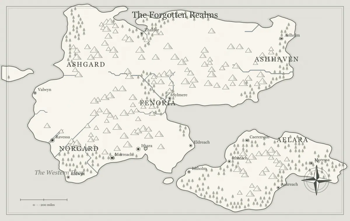
Scale helps a fantasy map answer a practical question: how large is the world shown here? It connects the illustration to distances in your setting, but it does not automatically determine travel time, population, or the size of an exported file. Those are separate decisions. A useful scale is one you define deliberately, apply consistently, and explain at the level the audience needs. False precision can make a setting harder to maintain than a clear broad assumption.
This guide uses an original region called the Ashmere Reach and a map from the fantasy map maker. The generator's scale reference is illustrative rather than surveyed geography. We will choose a fictional scope, compare distances and travel conditions, and keep image resolution separate from world size. If you need a custom scale annotation on the artwork, use a suitable exported layout or vector workflow; the current browser editor does not calculate every measured route for you.
Define the geographic scope first
Decide whether the map shows a local area, a region, a continent, or a world. The same visual coastline can be interpreted at different fictional sizes, but your project should not switch between those interpretations accidentally. Ashmere Reach is a regional overview connecting a home port, an inland market, and an offshore island. That scope suggests the kinds of journeys and relationships you need to describe.
Write the assumption in the notebook before assigning exact distances. A one-shot island and a continent-spanning novel may use similar-looking artwork for different purposes. The map type guide helps establish the frame, while island shapes distinguishes silhouette from size. The image's pixel width does not decide whether the fictional island is small or vast.
Choose units your audience can follow
Use units that suit the project and keep them consistent. Miles, kilometers, or an explicitly fictional unit can all work if the audience understands the meaning. A fictional league needs a defined relationship if you use it for numerical comparisons. Avoid switching units in different chapters or session notes without a clear conversion, especially when precise distances affect decisions.
You can keep the public map less numerical than the private notes. A player overview may need “near the coast” and “beyond the ridge,” while your preparation records approximate distances. For a novel, exact units may be unnecessary unless they influence timing or logistics. The notebook guide helps preserve one source of truth so casual descriptions and detailed planning do not become contradictory.
Use a scale reference as an explicit assumption
A scale reference needs a relationship between a length on the illustration and a distance in the setting. If you define that relationship yourself, label it as part of the fictional map's design. The generator's decorative scale bar is not evidence that terrain or routes have been independently measured. Do not treat it as a survey or use the output for real navigation.
If your chosen scope conflicts with an existing annotation, revise or clearly explain the annotation in the receiving workflow before publication. Do not leave readers to reconcile two incompatible references. The tool limits guide explains the distinction between fictional illustration and measurement. An SVG export can support appropriate external editing, but preserve the edited source because those changes are not automatically part of the generator's saved settings.
Check proportions before detailed numbers
Compare the important relationships in broad terms. Is the island much nearer the port than the inland market? Does the ridge crossing sit between the towns that depend on it? If the intended relative arrangement is unclear, exact numbers may conceal rather than solve the problem. Choose or revise the geographic frame before building a detailed travel table around a mismatched illustration.
For Ashmere, the port-to-island relationship should look like a nearby coastal connection, while the inland market requires a more substantial journey. Record those relationships and then select approximate distances that remain coherent. The iteration guide helps diagnose structural problems, and the seed guide preserves the chosen starting arrangement.
Separate distance from elapsed travel time
Distance describes the length of a route in your chosen units. Travel time depends on pace, transport, terrain, weather, rest, waiting, and other conditions. A shorter ridge path can take longer than a river connection under the assumptions of your setting. Avoid assigning one universal speed to every line on the map unless your chosen game procedure deliberately simplifies travel that way.
Write the conditions beside an estimate. “Approximately two days in ordinary conditions with no major delay” is clearer than a duration presented as inevitable. The travel route guide develops meaningful route comparisons. For a novel, the same distinction lets a delayed crossing have consequences without changing the underlying geographic distance whenever the story needs another scene.
Measure the intended route rather than only the endpoints
A straight connection between two towns is not necessarily the path someone travels. A road can follow a valley, a boat can use an established landing, and a ridge route can detour toward a pass. Decide which route you mean before describing its length. You can keep the result approximate when the overview does not provide detailed path geometry.
Ashmere's port and market have both a river-and-road connection and an inland crossing. Their route profiles should reflect the actual chosen path, not only their separation in the image. The river guide explains navigability assumptions, and mountain ranges connects passes to movement. Keep detailed measurement claims proportional to the information the map really contains.
Use simple arithmetic with stated assumptions
If a fictional route is defined as 60 distance units and your planning assumption is 20 units of progress per travel day, the simple estimate is three travel days before extra delays. That arithmetic is a model you chose, not a guarantee from the generator. A different pace or route condition changes the estimate. Keep the input assumptions visible so you can revise the result coherently.
Do not mix movement time with total elapsed time. Waiting for a boat, stopping to investigate a location, or resting longer can add time without changing the route's distance. In a campaign, use the procedures your group prefers. In a novel, check the timeline against scenes and established conditions. A clear simple model is more useful than precise-looking results whose assumptions vary silently from one journey to the next.
Use scale to review settlement relationships
The chosen world size affects how you interpret settlement spacing. A small regional map may show several nearby service towns, while a continental view may display only major centers. Do not assume every unlabeled area is uninhabited. The map's editorial selection and geographic scope can omit places that exist in the setting but are not important at this level.
Review whether the important settlements have understandable supply and movement relationships. The city placement guide connects water, resources, and routes. The trade guide develops dependencies. Scale should support those connections without forcing you to populate every gap merely because it covers a large fictional area.
Keep several map levels consistent
A world overview and a regional interpretation can show different amounts of detail while preserving major landmarks and relationships. Record which region the closer view represents and which facts must match. The current generator does not automatically create an exact matching close-up of every earlier output, so do not promise mathematical continuity that the workflow has not established.
You can reconcile a regional interpretation through shared names, coastline relationships, and route assumptions, or use a different external workflow when exact matching geometry is required. The limits guide explains the distinction. Keep approved references and notes together so a later detailed map does not accidentally relocate a major pass or change the distance framework of the whole setting.
Keep image resolution separate from world scale
Pixels describe the raster image, not the fictional world's size. Exporting a map at a larger pixel scale can improve its usefulness for a particular print or screen destination without enlarging the island in the story. Likewise, placing the same image at a smaller physical size changes how its labels read, not how far a character travels between towns.
The print resolution guide connects pixel dimensions to physical placement, and format comparison distinguishes raster images from SVG. These are delivery decisions. Keeping the two meanings of scale separate prevents a high-resolution export from being mistaken for evidence of more geographic precision.
Explain only the precision the audience needs
A public handout can use broad distances and route notes while private preparation contains a more detailed model. If a precise figure changes the audience's choice, explain its assumptions. If the exact number adds no useful information, a relative description may be clearer. Do not make readers solve a conversion puzzle merely to understand which destination is nearby.
For Ashmere, the public map can identify the island as a coastal journey and the market as a longer inland connection. The route note can explain the usual transport and major uncertainty. The audience version guide helps separate information appropriately, while label typography keeps annotations from crowding the main geography.
Compare two Ashmere route estimates
Suppose your fictional planning model gives the ridge route a length of 80 units and assumes 20 units of progress per travel day. The simple movement estimate is four days. A longer river route of 100 units with 25 units of daily progress also gives four movement days. These are invented inputs for the example, not real travel recommendations or measurements taken from the generator. They demonstrate why a longer route need not take more movement time.
Now add one day of waiting for river transport. The river option takes five elapsed days under that scenario, while the ridge estimate still needs any rest or delay assumptions you intend to apply. A courier with immediate boat access could face a different comparison. Keep the route distances stable and change the relevant conditions explicitly. This makes the timeline understandable and lets you revise a particular journey without changing the whole world's size.
Separate measuring a route from timing it
Once you have assigned a scale and measured a route, enter its distance in the travel time tool. Keep distance and pace in the same unit. A 60 km route at 5 km per hour needs 12 moving hours on ordinary terrain; a terrain multiplier of 0.5 doubles that time to 24 hours. Choose your own daily travel hours to divide the result into days. These are fictional planning assumptions. The tool calculates from your inputs and cannot establish scale or measure paths on the illustrated map.
Test the scale through a timeline and a supply route
Choose one important journey and one regular shipment. Apply the same units and route assumptions to both. If the messenger crosses the region in a day while the ordinary route model requires several days under comparable conditions, explain the difference or revise the timeline. A special transport method can be valid, but it should have an established role rather than appear only to repair a contradiction.
Record the approved assumptions and save the map using the editable file guide. Scale becomes useful when it supports consistent decisions without claiming more accuracy than the illustration provides. Ashmere Reach can then remain coherent across scenes, sessions, and exports, while its geographic overview stays a readable tool rather than a page of unsupported measurements.
Give the idea a world of its own.
Try the technique in the generator, then save an editable copy so you can return to your work.
Open the map maker ↗