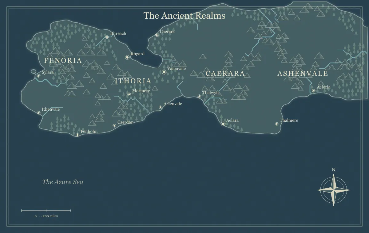
A fantasy kingdom becomes more convincing when its power connects to places, resources, and relationships. A realm name across the map can identify territory, but it does not explain how rulers reach distant towns, maintain roads, or obtain supplies. Those practical questions create opportunities for story and conflict. A useful political setting has understandable institutions and dependencies, even when its formal claims are ambitious or its history is complicated.
This guide develops an original realm called the Crown of Westmere around a map from the fantasy map maker. The generator supplies fictional geography and supported labels or landmarks. It does not create a complete political simulation or offer unrestricted territory-polygon editing. We will use the landscape to establish a capital, regional centers, routes, and competing interests while keeping detailed institutions in a compact notebook.
Define what the kingdom represents
Start with the political relationship rather than only the name. Westmere is a crown coordinating several market regions through agreements, officials, and shared routes. That definition leaves room for local institutions without assuming every town operates identically. A realm can claim broad authority while depending on communities whose practical cooperation matters more than the title on an official chart.
Write the public identity and the current situation separately. Westmere's broad claim is stable, while a dispute over maintaining the northern road creates today's pressure. The border guide distinguishes claims from practical control. The faction guide connects rule, ownership, and influence to concrete assets rather than treating all forms of power as one colored area.
Choose the capital through its role
The capital need not be the largest city or the geometric center of the map. Decide which institutions operate there and why that location matters. Westmere's capital sits near a junction linking the river market and coastal road. Its role is coordinating records, negotiations, and supply. A historical reason can also explain the location, including costs the realm still manages.
Separate the capital's political role from other settlements' economic importance. The main port can handle more cargo while the capital houses the council. This gives the setting several meaningful centers. The city placement guide connects settlements to water, resources, and routes. A capital becomes believable when its institutions have relationships to the region rather than appearing as a larger marker with no supporting network.
Give regional centers distinct functions
Select a small number of centers the audience needs to understand. Westmere has the capital, a coastal port, an inland farming market, and a pass settlement. Their roles explain movement and negotiation. You do not need to invent every provincial office before the region can support a story. Choose the institutions and services that affect the project's current decisions.
Record what each center provides and what it needs. The port supplies imported tools, the farming market provides food, and the pass settlement maintains a route between regions. The trade guide develops resource dependencies. These relationships make the kingdom feel connected without requiring one universal model of government or an exact budget for every town.
Ask how authority travels
Officials, messages, goods, and support need routes. Decide which connections the realm can use reliably and which depend on local cooperation. Westmere's southern road has regular services, while the northern route depends on a pass and a community-maintained crossing. This difference explains why the crown's practical influence varies even inside its formal claim.
Do not infer a fixed administrative reach solely from straight-line distance on the image. Terrain, transport, waiting, and services matter. The route guide compares those factors, and scale planning keeps fictional distance separate from elapsed travel time. A kingdom's network can create useful constraints without becoming a detailed numerical simulation.
Connect power to food and materials
Institutions need ordinary supplies. The capital depends on food from the inland market, the port needs timber for repairs, and the pass station receives tools and provisions along the road. These dependencies can create cooperation as well as conflict. A disrupted shipment can reveal the network more clearly than a long explanation of the realm's hierarchy.
Choose the resources relevant to the story and keep particular environmental claims supported. The climate guide establishes broad assumptions, while forest planning connects work sites to routes and residents. Westmere's geography becomes political when decisions about access and maintenance affect who can fulfill their responsibilities.
Preserve local institutions and overlapping interests
A crown can depend on ferries operated by an association, warehouses owned by families, and trails maintained by villages. Those groups do not need to become separate sovereign kingdoms to matter. Decide which agreements make cooperation work and what each group can withhold or provide. This creates political texture at the places characters actually visit.
Westmere's ferry association accepts public traffic rules but negotiates repair support with the capital. The northern village maintains a trail the official road map barely records. The frontier town guide develops overlapping authority, and faction mapping organizes current goals and assets. Local institutions can have understandable interests without every disagreement becoming a war.
Use terrain as an influence rather than destiny
A ridge can complicate access, a river can connect markets, and a coast can support outside exchange. None of those features automatically dictates one political arrangement. Two communities separated by mountains can still maintain a pass agreement. A river can serve as a border or a shared network. Choose the relationship that follows your setting's history and current institutions.
The mountain guide, river guide, and coastline guide develop those geographic opportunities. Westmere's political map should explain why particular terrain matters without pretending that every landform produces the same kind of rule. The physical map supplies constraints and connections; people determine the agreements built around them.
Give the realm a history that affects its present
Choose one or two past developments with visible consequences. Westmere may have inherited a claim to northern stations while losing the route that supplied them. An older market town may retain institutions after the capital moved. These facts can explain practical mismatches between the official map and daily life without requiring a complete chronology of every ruler.
Record the surviving evidence: roads, buildings, records, names, and local expectations. The landmark guide connects past function to present sites. A historical claim becomes useful when it influences a current decision, such as who repairs a station or whether a community recognizes an old fee agreement.
Choose a conflict rooted in the network
Westmere's current dispute concerns who pays to repair the northern road. The farming market needs transport, the capital needs supplies, and the pass community wants recognition for its maintenance work. These interests overlap. Several outcomes can address the problem, and each may change a relationship without replacing the whole government.
Write what each group wants, what it can do, and what it may try next. Avoid making the conflict depend only on vague rivalry. The sandbox guide connects several situations through meaningful choices. For a novel, the same structure can make a character's action at one location affect institutions elsewhere, giving political consequences a geographic foundation.
Choose a viewpoint for the political map
An official chart may show the crown's claims, while a merchant overview emphasizes usable routes and services. A public reader map may simplify both. Decide which version you are making and explain important limitations. The audience should not have to guess whether a realm label represents accepted administration, disputed territory, or a broad geographic association.
Keep secret plans and concealed assets in a separate author or game master reference. The audience version guide organizes known, rumored, and private information. A political map can be informative without revealing every prepared consequence. Review markers, captions, and filenames as well as labels before distributing a public version.
Keep the political presentation readable
Use broad realm labels and selected centers for a simple overview. If you need custom boundaries, overlays, or a detailed legend, use a suitable external layout or vector workflow. The current browser tool does not provide unrestricted polygon construction. Preserve externally edited sources separately because the generator's JSON does not automatically include changes made elsewhere.
Distinguish political names from physical region and settlement names. Westmere is the realm, North Vale is a region, and Reedgate is a town. The naming guide supports that hierarchy, while typography keeps labels clear. Explain category meanings in prose rather than relying only on color.
Update political facts through specific events
A new maintenance agreement, occupation of a station, or changed market rule should be recorded precisely. A temporary permit does not necessarily transfer territory. A service becoming unreliable does not erase a formal claim. Distinguish the practical change, its public visibility, and its expected duration before updating the map or index.
The maintenance guide separates world changes from knowledge changes. Save working files and approved pictures using the saving guide. Stable terrain can remain useful while authority and relationships evolve around it, and earlier maps can remain valid records of a past viewpoint.
Turn the northern road dispute into a concrete agreement
The pass community can offer labor and local route knowledge, but it lacks materials. The farming market can contribute supplies if the road reopens before its next major shipment. The capital can coordinate the arrangement, but its storehouse has competing demands. Write those contributions separately. The resulting negotiation concerns an understandable practical problem, not an abstract test of whether the crown is powerful enough to command everyone.
One possible agreement sends materials through the ferry association while the pass community performs the work. Another uses a longer road to avoid the river delay. A third postpones the repair and supports an alternative route for the current season. Each option changes costs, timing, and relationships. You can prepare the interests and constraints without deciding that only one outcome is legitimate for the story or campaign.
Record what the chosen agreement actually establishes. A group may gain access to a service, recognition for maintenance, or a temporary exception to a fee. None of those automatically changes the entire realm's boundary. When the audience later consults the map, a revised route note or public center label may be enough. This keeps Westmere's political development tied to specific events and helps you show how institutions respond to ordinary needs as well as extraordinary threats.
Test Westmere through a request for help
Imagine the pass community asks the capital for repair materials. Trace the message, the decision, the supplies, and the route. Identify who must cooperate and what alternatives exist if one connection fails. If the answer relies only on a ruler's title, develop the network before adding more districts. This simple test makes the kingdom's institutions concrete.
Review the exported map at the intended size using the export guide. Westmere becomes convincing through connected centers, ordinary dependencies, local agreements, and consequences that follow from them. The generator offers a geographic beginning; deliberate political reasoning turns the realm name into a living setting people can understand, influence, and maintain.
Give the idea a world of its own.
Try the technique in the generator, then save an editable copy so you can return to your work.
Open the map maker ↗