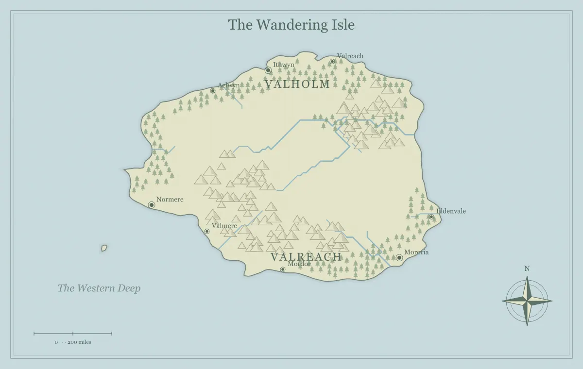
An island's shape can influence the kind of story its map supports. A long island encourages journeys along a spine of land. A broad island can hold contrasting inland regions. A deeply indented coast can create several ports and indirect routes. A smaller compact island can help contain a short adventure. None of those shapes comes with a complete narrative automatically, but each offers a different set of relationships you can develop.
This guide compares fictional island frames using the fantasy island map generator. The current tool generates candidates from its type, seed, and settings; it does not provide a separate button for every named shape discussed here. Select a useful candidate or use a suitable external vector workflow if exact geometry matters. We will focus on recognizing broad relationships, matching them to a purpose, and avoiding an endless search for a perfect outline.
Choose the island's job before its silhouette
Write a short purpose for the map. A rescue adventure needs an arrival point, an objective, and understandable routes. A novel setting may need several communities with different resources. A nautical campaign may need ports connected to nearby islands. These purposes suggest different geographic frames. An attractive coastline can still be unsuitable if it makes the important relationships difficult to explain.
For the examples, keep three projects separate: a short adventure on Gull Isle, a longer journey on Longreach, and a regional setting on Hearth Island. Comparing them by purpose is more useful than ranking their silhouettes universally. The map type guide distinguishes an island from a world or archipelago, while the workflow guide turns a brief into a practical sequence.
Compact islands support a clear frame
A compact island can make the whole setting easy to introduce. Gull Isle has a sheltered landing, an inland ridge, and a headland destination. The audience can understand the main arrangement without a long geographic explanation. That containment can be helpful for a one-shot or a short story where only a few places need to become important.
Containment does not require one forced route. A coastal path and an inland crossing can offer different approaches within a small frame. Decide the useful alternatives and what travelers know about them. The island one-shot guide develops a focused adventure with several responses. A compact map is successful when it limits unnecessary scope while preserving meaningful decisions.
Long islands can organize a journey
A long island can create a strong relationship between distant ends and intermediate stops. Longreach has a southern harbor, a central crossing, and a northern settlement. The shape suggests a journey through a sequence of regions, but you can still provide coastal and inland alternatives. The outline supports the frame; the notes decide whether travel is easy, difficult, or interrupted by barriers.
Do not assume every elongated island has one continuous road or uniform terrain. A ridge, river, or narrow section can change movement. Give the intermediate places functions rather than making them identical stops. The journey guide connects geography to narrative decisions, and travel routes separates distance, effort, and available information.
Broad islands can hold contrasting regions
A broad island can provide space for several communities and inland relationships. Hearth Island has a coastal port, a farming valley, and a hill settlement. Their different roles give the setting depth beyond movement around the shoreline. Use the broad shape to establish connections rather than filling every area with a separate kingdom merely because the image offers room.
Choose one regional contrast that matters. The port may depend on inland food, while the hill settlement supplies materials for repairs. Those relationships can support conflict and cooperation. The city placement guide explains settlement functions, and trade routes connects production to movement. A broad island can feel rich through a few dependencies without requiring a large population inventory.
Narrow connections create places worth explaining
An island with a narrow middle or peninsula can concentrate movement in a particular area. That feature can support a crossing town, a checkpoint, or a meeting place between communities. Decide what makes the connection important and who uses it. A small geographic bottleneck becomes a useful setting element when it affects access, supplies, or authority.
Keep the control assumptions clear. A group may watch the road through the narrow area without controlling every coastal landing nearby. The faction guide distinguishes practical assets from broad claims, while frontiers explains uncertain authority. The map should show the relationship, and the notes should explain what changes when someone passes through it.
Indented coastlines can support several coastal identities
A coast with several noticeable bays can suggest different landings and port communities. Choose which sites matter to the project instead of naming every indentation. One bay might handle public trade, another support boat repairs, and another provide a remote landing with few services. The outline alone does not measure depth or safety, so establish the conditions relevant to your fiction.
Connect each important bay to inland routes and resources. Otherwise, the ports can become interchangeable names around the edge. The coastline guide develops bays, headlands, and river mouths, and nautical campaigns uses ports as part of a wider network. A varied shore is most useful when its sites create distinct opportunities.
Read island shape together with terrain
The same broad outline can support different stories depending on its internal terrain. A central ridge can separate communities, while a valley can connect them. A river can create a crossing or a resource relationship. Judge a candidate through both coastline and major terrain rather than choosing an outline and assuming every required route will appear naturally inside it.
For Hearth Island, a ridge creates a choice between a serviced pass and a coastal detour. For Gull Isle, a smaller barrier can support one focused obstacle. The mountain guide and river guide explain broad relationships without treating the generated illustration as a detailed elevation or hydrological model.
Decide whether nearby islands change the frame
A main island with a small offshore neighbor can remain a single-island setting if the neighbor has one supporting role. A beacon island or refuge can connect to the main coast without requiring a full nautical campaign. If several separate islands become equally important, an archipelago frame may communicate the setting more clearly.
Choose the frame according to what the audience needs to compare. Gull Isle's beacon neighbor is one destination; the Lantern Keys are a network of ports and passages. The archipelago geography guide explains that network, and the archipelago generator offers the relevant map type. Scope should follow the relationships, not a desire to use every possible landform.
Establish size independently of the picture
A compact-looking island can be small or large in your fictional world. The image dimensions and coastline shape do not decide that scale by themselves. Define the intended size and apply consistent assumptions to travel, settlement, and supply. An illustrative scale reference is not a measured survey, so avoid precise durations that the project has not established.
The scale guide separates geographic distance from travel time and image resolution. For a short adventure, you can choose a scope that keeps the important locations within a manageable journey. For a novel, a longer trip can support different consequences. Record the assumption so later maps and scenes do not accidentally treat the same island as two incompatible sizes.
Select candidates with a limited comparison
Generate a small set and record why each promising result fits the brief. Gull Isle needs a landing and headland relationship. Longreach needs clear distant ends and intermediate space. Hearth Island needs room for regional contrast. Reject candidates for a concrete mismatch rather than a vague feeling that another random result might be more impressive.
Save the selected inputs and working file before editing. The seed guide explains repeatable starting points, and iteration helps separate a structural issue from a local correction. If the shape supports the purpose, names and presentation can often make it useful without more regeneration.
Know the limits of local editing
You can rename and move supported labels and add available landmarks, but the current browser interface is not an unrestricted coastline drawing tool. If you need an exact crescent, a particular inlet, or a matching detailed crop, use an appropriate external workflow with a suitable export. Preserve the edited source separately because the generator's seed will not automatically recreate every external change.
The limits guide distinguishes procedural illustration from complete custom mapping, while format comparison explains the role of SVG. Sometimes the better choice is simply interpreting a generated island through a slightly revised brief. Make that decision before investing heavily in labels that depend on geography you intend to replace.
Use naming hierarchy to reinforce the frame
Name the island, the important regions, and the selected destinations at different levels. Longreach is the island, North Vale is a region, and Salt Landing is a port. This gives the audience a clear vocabulary for broad orientation and specific travel. Keep major spoken names distinct, and leave minor features unnamed until they matter to the story.
Check labels at the intended viewing size. A long island name can fit across open space, while a port label needs room near a small marker. The naming guide supports layered names, and typography explains hierarchy. A clear label system can make a simple outline feel more coherent than an intricate coast crowded with equally weighted words.
Test each shape through its intended use
Describe the first decision a reader or player makes with the map. On Gull Isle, it is choosing an approach to the objective. On Longreach, it is understanding the journey between ends. On Hearth Island, it is comparing communities and their dependencies. If the outline and terrain support that decision clearly, the candidate has a practical reason to be approved.
Save the editable file and inspect the actual exported image using the export guide. Shape is a starting opportunity, not a complete story formula. A useful fantasy island combines a geographic frame with coherent routes, resources, names, and audience information. Choose the frame that helps your project, then develop the relationships that make the island a place people can understand.
Give the idea a world of its own.
Try the technique in the generator, then save an editable copy so you can return to your work.
Open the map maker ↗