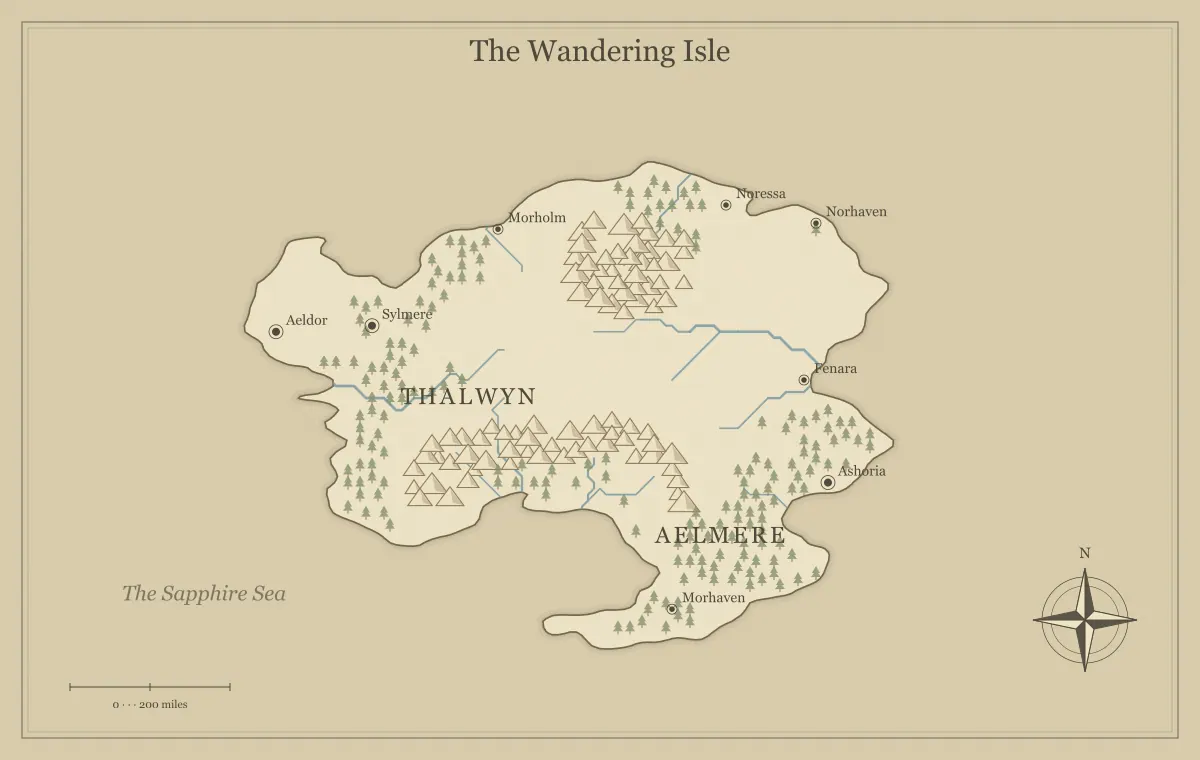
An island is a useful frame for a DND one-shot because its coastline gives the adventure a clear geographic boundary. The group can understand the setting quickly: a landing, a few destinations, an inland barrier, and a reason to act. That containment helps preparation, but it does not automatically control pacing. A one-shot still needs a focused situation, obtainable information, and several ways to make progress without spending the whole session debating where to begin.
This guide creates an original adventure region called Gullhaven Isle with the fantasy island map generator. The example is independent of published game settings and does not prescribe a particular rules system. A coastal beacon has stopped operating before a supply ship arrives. We will use the map to organize a landing, three connected locations, and a final decision that fits a limited session.
Choose a problem with a visible consequence
The island's problem should be understandable without a long history lesson. On Gullhaven Isle, the beacon is dark, and the arriving ship needs a safe approach. This immediately explains why the landing, coast, and tower matter. The characters can investigate the interruption, help restore the signal, or find another way to warn the ship. Several approaches serve one clear objective.
State what happens if the group does nothing, but keep the consequence proportional to your intended tone. A delayed landing, damaged cargo, or dangerous approach can create urgency without requiring a catastrophic threat. The map can show the exposed headland and sheltered bay that make the situation credible. The campaign world guide uses a similar relationship between a starting place and a current problem, while a one-shot keeps that relationship especially compact.
Select an island shape that supports the journey
Generate a few candidates and look for a useful relationship between the landing and the beacon site. A ridge between them can create a route choice. A sheltered bay can explain the arrival point. An exposed headland can explain why the beacon matters. You do not need a highly intricate island if its geography complicates the brief more than it helps the adventure.
Save a candidate that supports those relationships before editing names. Record the settings and download a working file once you begin manual changes. The island shape guide compares geographic frames for different stories, and the seed guide explains how to preserve a repeatable starting point. Choose a usable island, then spend preparation time on the situation rather than searching indefinitely for a perfect coastline.
Make the landing a useful starting scene
The landing should introduce the objective, provide basic orientation, and offer an initial decision. Gullhaven's bay has a small quay, a storehouse, and a caretaker who knows the normal beacon routine. The caretaker can explain that the keeper did not return from the headland and that a recent rockfall affected the ridge path. This provides useful facts without revealing what the characters will find.
Give the scene a practical action as well as conversation. The group might inspect a damaged signal lamp, choose supplies, or ask a local boat owner about the coast. These actions can establish tone and create the first route choice. Avoid spending most of the session on unrelated town business. The landing exists to support this adventure; broader island history can remain in a few notes until the group asks a relevant question.
Prepare three connected locations
A compact one-shot can use the landing, an intermediate location, and the beacon headland. The intermediate site might be an old quarry shelter where the missing keeper stopped. Each location should contribute to the current problem. The quay gives orientation, the shelter explains a complication, and the headland presents the final situation. Optional details can enrich them without becoming separate adventures that compete for time.
Prepare the people, evidence, and possible interactions at each site. A regional marker is not enough by itself, but you do not need a full local map unless precise movement will matter there. The landmarks guide helps connect a shelter or tower to its history and function. Keep local encounter preparation separate from the island overview so the geographic map remains readable.
Offer two useful routes rather than many vague ones
From the quay, the group can follow the ridge path or travel along the coast by boat. The ridge route avoids dependence on a boat but crosses the recent rockfall. The coastal route reaches the headland efficiently under favorable conditions but has an exposed landing. These differences support a decision connected to the objective. A third route is unnecessary unless it adds a genuinely different possibility.
Make the tradeoffs obtainable at the starting scene. The caretaker knows the ridge conditions, while the boat owner knows the coastal approach. Players can then compare risks rather than choosing blindly. The travel routes guide explains how information, transport, and obstacles make routes meaningful. In a one-shot, concise route information protects time while still letting the group choose its approach.
Place essential information where it can be found
The adventure should not depend on the characters noticing one tiny mark on the map or succeeding at one particular action. Put important information in several appropriate forms. The damaged lamp at the quay, tracks near the shelter, and the keeper's message can all indicate that the beacon failure has a practical cause. They need not repeat identical text; together they help the group understand what to investigate.
Keep optional discoveries separate from information needed to move forward. An old island legend can be rewarding background, while evidence of the keeper's route supports the current task. The map can orient the group, but nearby prose and scene details should carry essential explanations. If the group chooses the boat route and skips the shelter, make sure the headland situation is still understandable through evidence available there.
Use geography to support pacing
A one-shot has limited play time, so choose a scale that keeps travel connected to the scenario. You can summarize uneventful movement and focus on places where a decision or discovery matters. Do not feel required to prepare an encounter at every bay simply because the generator produced an interesting coastline. The map's detail is available for atmosphere; it does not dictate the session's scene count.
Watch the group's progress and keep the main objective visible. If early conversation takes longer than expected, an intermediate location can provide its information efficiently rather than expanding into another complex situation. This is a preparation choice, not a claim about one universal pacing formula. The scale guide helps separate fictional distance from table time and from the travel procedures you choose for the game.
Prepare a final situation with several responses
At the headland, the keeper may be injured beside a damaged beacon mechanism. The group can repair the mechanism, create an alternative signal, or coordinate with the ship through another plausible method. The geography can inform those options: an elevated headland provides visibility, while the exposed landing creates practical risk. Prepare the situation and relevant constraints rather than one required sequence of actions.
Decide what success looks like at the level of the objective. A safe ship approach can count even if the beacon remains damaged and needs later repairs. Different solutions can have different costs or consequences. This gives the players room to be creative while keeping the session focused. A one-shot map supports a coherent place for their decisions; it should not become a diagram of the only solution you will accept.
Keep the player map free of unintended reveals
The player version can show the quay, ridge, headland, and known shelter. It should not reveal the keeper's exact condition or a concealed feature that the characters have not learned. Check icons as well as labels. A private marker on an otherwise empty headland can disclose the location of an important discovery even if its text is removed.
Save a separate private version or keep private details in location notes. The player and DM map guide provides a systematic audit of known, rumored, and private information. Also check the exported filename and surrounding caption. A neutral map named gullhaven-player.png is easier to distribute correctly than several ambiguous downloads containing different levels of information.
Export a clear handout before the session
Use distinct place names and a readable style at the size the group will see. The island title, landing, and beacon headland should be recognizable without close study. Print a test if the map will be physical, or view it on a smaller screen if you are sharing online. The smallest decorative names do not need the same emphasis as the places central to the objective.
Open the actual PNG, JPG, or SVG export and inspect the whole frame. Keep an editable JSON file for any final correction. The export guide explains format and size checks, and label typography covers hierarchy. A handout that loads quickly and reads clearly is more useful during a short adventure than a very large file filled with information the group will never need.
Keep a compact Gullhaven session plan
A one-page preparation note can hold the objective, the two routes, the keeper's situation, and the evidence available at each location. Put the crucial information near the top so you can find it during play. Mark the old island legend as optional background rather than letting it compete with the signal problem. If the group asks about the legend, you can answer briefly without introducing a second required objective.
Also note the alternatives that remain possible if the beacon cannot be repaired. An improvised signal or a message carried by boat can still address the ship's approach when the fiction supports it. Preparing those possibilities helps you respond to inventive plans while preserving a clear ending. The island map provides the physical relationships that make the alternatives understandable.
Leave a recoverable setting after the one-shot
After the session, note the group's solution and any consequences worth preserving. The repaired quay, new island contact, or improvised signal method can become part of Gullhaven's history if you return. Save an approved map version reflecting important changes, but do not develop the entire surrounding ocean unless another adventure needs it. A small island can remain a complete useful setting on its own.
The strength of an island one-shot is focused geography combined with flexible decisions. Gullhaven Isle gives the group a clear landing, a visible problem, two approaches, and a final situation that supports several solutions. The map helps everyone understand the place while preparation concentrates on the scenes that matter. That balance makes a generated island more than a backdrop and keeps the adventure manageable within a limited session.
Give the idea a world of its own.
Try the technique in the generator, then save an editable copy so you can return to your work.
Open the map maker ↗