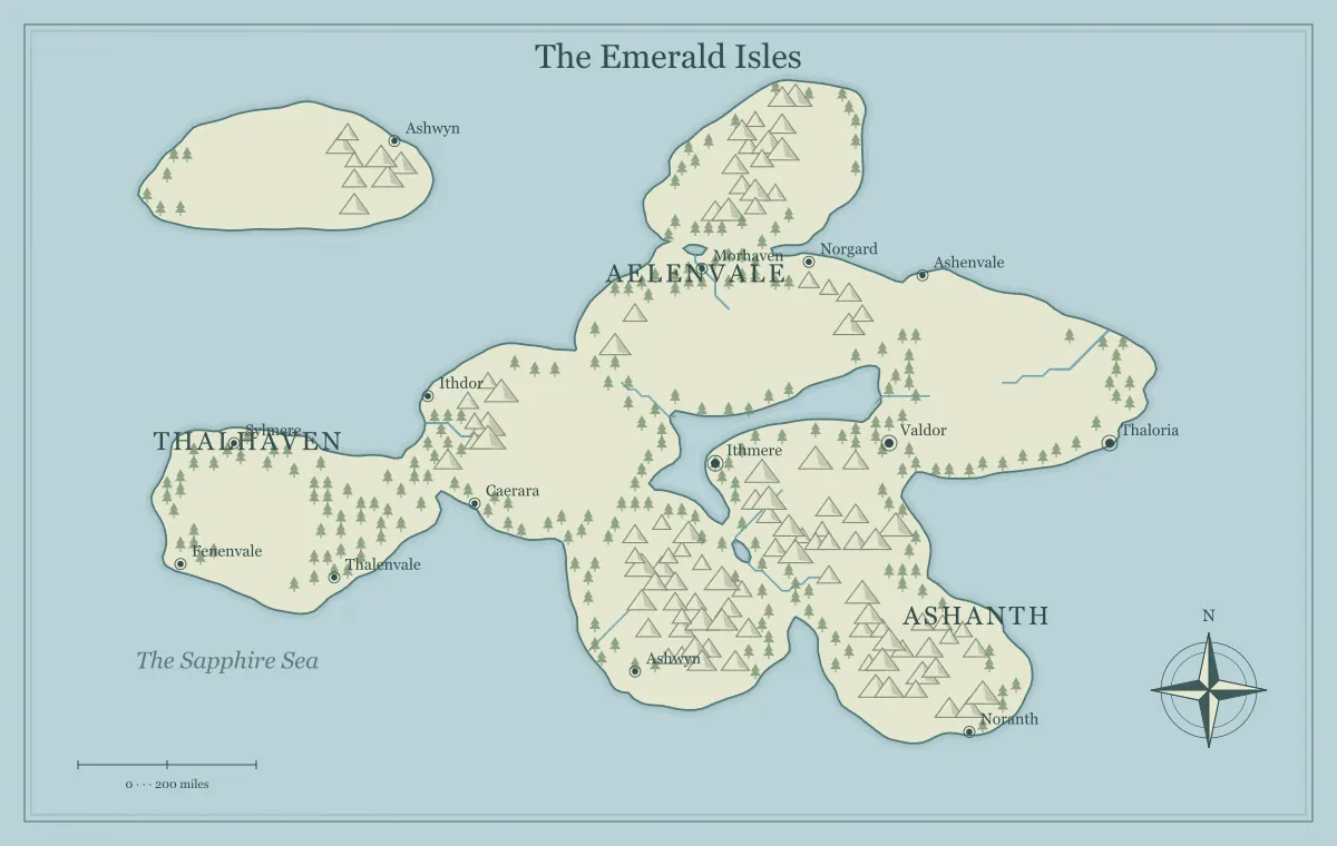
A pirate campaign across a fantasy archipelago needs more than a collection of attractive islands. The islands should offer different reasons to visit, and the water between them should create choices about routes, shelter, supplies, and information. A port can be safe for one crew and hostile to another. A narrow channel can become valuable because it connects trade. A remote island can matter because it provides a landing when weather makes the main route difficult.
This guide develops an original region called the Lantern Keys with the fantasy archipelago map generator. The example is suitable for a DND-style regional campaign but is independent of game publishers and does not prescribe naval rules. We will give the island chain a useful structure, connect ports and factions, and prepare a readable player map. The goal is an ocean the group can reason about, not an empty gap between separate adventures.
Choose a campaign premise that makes the sea important
Start with a present situation. In the Lantern Keys, several ports depend on a central channel whose navigation beacons have become unreliable. Merchants, independent crews, and a coastal authority disagree about who should maintain the route and who may collect fees. This makes movement central to the campaign. The characters can investigate failures, escort ships, negotiate access, or explore alternative passages.
A pirate campaign can involve theft, pursuit, and rival crews, but a regional map should also show why ships travel at all. Trade, supplies, refuge, and communication give the sea a practical network. Write the premise in one sentence and identify the geographic relationships it requires. The campaign world guide connects starting places to current problems, while trade routes explains how goods and movement can shape a setting.
Choose an island chain with useful relationships
Generate a limited set of candidates and look for varied island sizes, visible passages, and room for port labels. A central large island can support a major market, while smaller islands can provide shelter or specialized resources. You do not need every island to be equally important. The chain should have a recognizable structure that players can understand after a brief introduction.
For the Lantern Keys, choose a main market island, two outer islands, and several smaller landforms that can become later discoveries. Save the settings and a working file before developing names. The archipelago geography guide explores how island groups feel connected, and the seed guide explains how to preserve the selected starting point without treating it as a complete backup of later edits.
Give each main port a distinct role
Three memorable ports are more useful than twelve interchangeable ones. Beaconport is the public market and repair center. Salt Quay supplies preserved food and fresh water from its island's inland springs. Rook Haven offers a sheltered anchorage controlled by independent crews. Their roles give ships reasons to move between them and create different social situations for the characters.
For each port, record what visitors need, what the port provides, and what makes access uncertain. Beaconport may inspect cargo. Salt Quay may ration supplies during a dry season. Rook Haven may require an introduction from a trusted crew. Keep these as practical conditions rather than assuming every port has a neatly defined moral alignment. The city placement guide helps connect settlements to water, resources, routes, and defensible locations.
Map routes through choices and constraints
Define the common passages between the main ports. The central channel is direct and well known, but fees and unreliable beacons complicate it. An outer route avoids the authority's inspection, but offers fewer safe landings. A narrow inner passage can save time for crews with local knowledge while creating risk for unfamiliar ships. These differences make route selection part of play.
Make the relevant information obtainable through charts, harbor conversations, and experienced sailors. Do not hide every navigational fact until after the group chooses. Also avoid treating the generated artwork as a real nautical chart: its coastlines and scale are fictional illustrations. The travel route guide explains meaningful tradeoffs, and scale and distance helps establish consistent fictional assumptions for the campaign.
Make supplies part of the island network
Food, water, repairs, and shelter connect the islands even when no immediate adventure is happening. A port that repairs hulls may need timber from another island. A food-producing island may depend on imported tools. A refuge may offer shelter but little fresh water. These relationships explain why crews cooperate, compete, and negotiate access instead of treating the ocean as a sequence of isolated encounters.
Keep the detail proportional to the campaign's interests. If your group enjoys logistics, you can prepare more explicit supply assumptions. If it prefers fast-moving adventure, a few meaningful constraints may be enough. The map should show the important ports and relationships while the notebook holds the working details. The notebook guide helps maintain these facts without filling the image with long text beside every island.
Attach factions to control of places and services
The coastal authority controls Beaconport's inspection office and some beacon stations. The independent crews influence Rook Haven and several outer landings. Salt Quay's suppliers can affect provisions throughout the chain. Their influence is geographic, but it does not necessarily form three clean blocks of territory. A faction can control a service in a port without ruling the whole island.
Record a current goal and a likely action for each group. The authority wants reliable fees, the crews want access without inspection, and the suppliers want stable delivery. Their interests can create temporary alliances and disagreements that the players influence. The faction mapping guide distinguishes ownership, claimed territory, and practical control. Use those distinctions to avoid a political overlay that oversimplifies the campaign's actual relationships.
Use small islands as purposeful secondary places
Minor islands can provide shelter, a lookout, an abandoned beacon, or a place to meet away from a port. Give each one a specific function when it enters play. A small island is not automatically an adventure just because it has a dramatic silhouette. Its value may be that a crew can wait there safely while watching traffic through the central channel.
Leave some minor islands unnamed on the first player map. They can become relevant when the group seeks a new landing or follows a lead. Keep provisional ideas in your private notes instead of presenting every possibility as established public knowledge. The island shape guide connects form to story function, and landmarks helps give an abandoned station a history and present situation.
Let conditions affect routes coherently
Weather and sea conditions can change the value of a passage. An exposed outer route may be attractive in calm conditions and undesirable during a storm. A sheltered channel may become crowded when other paths are unsafe. These changes should follow from the geography and the campaign's established assumptions. They make islands and anchorages matter without requiring a new coastline after every event.
Communicate observable warning signs and useful local knowledge. A harbor master can discuss expected conditions; an experienced crew can suggest a shelter. Do not use weather only as an arbitrary way to cancel a player decision. It can create a revised choice, a delay, or a reason to negotiate for access. The climate guide helps distinguish broad regional patterns from the conditions of one particular journey.
Build a player chart with an explicit viewpoint
The first chart can show the main ports, common passages, and known beacon sites. It may represent a merchant chart rather than a perfect record of every inlet. Mark uncertainty in accompanying text when it matters. A rumored landing can remain a broad lead instead of a precise symbol that reveals its exact location. The group should understand which information is reliable enough for planning.
Keep private smuggler routes, concealed caches, and faction plans in a separate version or location index. Inspect icons, names, title, and filename before sharing the chart. The player and DM guide provides a knowledge audit. A clear public map should help players compare options while preserving discoveries, not force them to guess because every useful geographic fact was removed in the name of secrecy.
Name the chain and islands at different levels
The Lantern Keys is the group name, while the main islands and ports have their own names. This hierarchy helps the players locate the region before discussing a specific landing. Keep the most important spoken labels distinct. Beaconport, Salt Quay, and Rook Haven are easier to distinguish in conversation than several ports beginning with the same invented syllable.
Record aliases where they serve the fiction. Independent crews may use a different name for a harbor than the authority's official chart. Show one principal label on the current handout and keep alternatives in the notebook. The naming guide explains this layered approach, while name generation offers suggestions you can adapt rather than treating generated words as verified translations or exclusive names.
Prepare one Lantern Keys voyage
For a first voyage from Salt Quay to Beaconport, give the group two useful reports. A supplier confirms that the central channel is the usual cargo route, while a returning sailor reports a damaged beacon near its narrowest passage. A Rook Haven contact offers information about an outer landing but expects a favor. The players can compare a direct route with a less inspected alternative before leaving port.
Prepare the damaged station as a situation with people, evidence, and several possible responses. Do not decide in advance that the group must repair it. They might investigate, escort another ship, negotiate assistance, or choose a different passage. Record what changes afterward, especially who now trusts the crew and whether the route becomes easier to use. One voyage can establish the network's importance without explaining the entire ocean.
Prepare the chart for play and later updates
Export a player image at a useful screen or print size and open the actual file before the session. Check port labels, channel relationships, and the complete frame. Keep an editable JSON file for future changes, and name public and private exports clearly. The export guide covers file formats, while editable saving provides a recovery workflow that does not depend on a single browser's recent state.
After play, update important changes: a repaired beacon, a new refuge, an altered inspection rule, or a discovered passage. The campaign maintenance guide helps distinguish new knowledge from physical or political changes. A pirate archipelago becomes a connected world when ports, supplies, routes, and factions influence one another. The Lantern Keys can then support ongoing choices at sea instead of functioning as separate adventures divided by empty water.
Give the idea a world of its own.
Try the technique in the generator, then save an editable copy so you can return to your work.
Open the map maker ↗