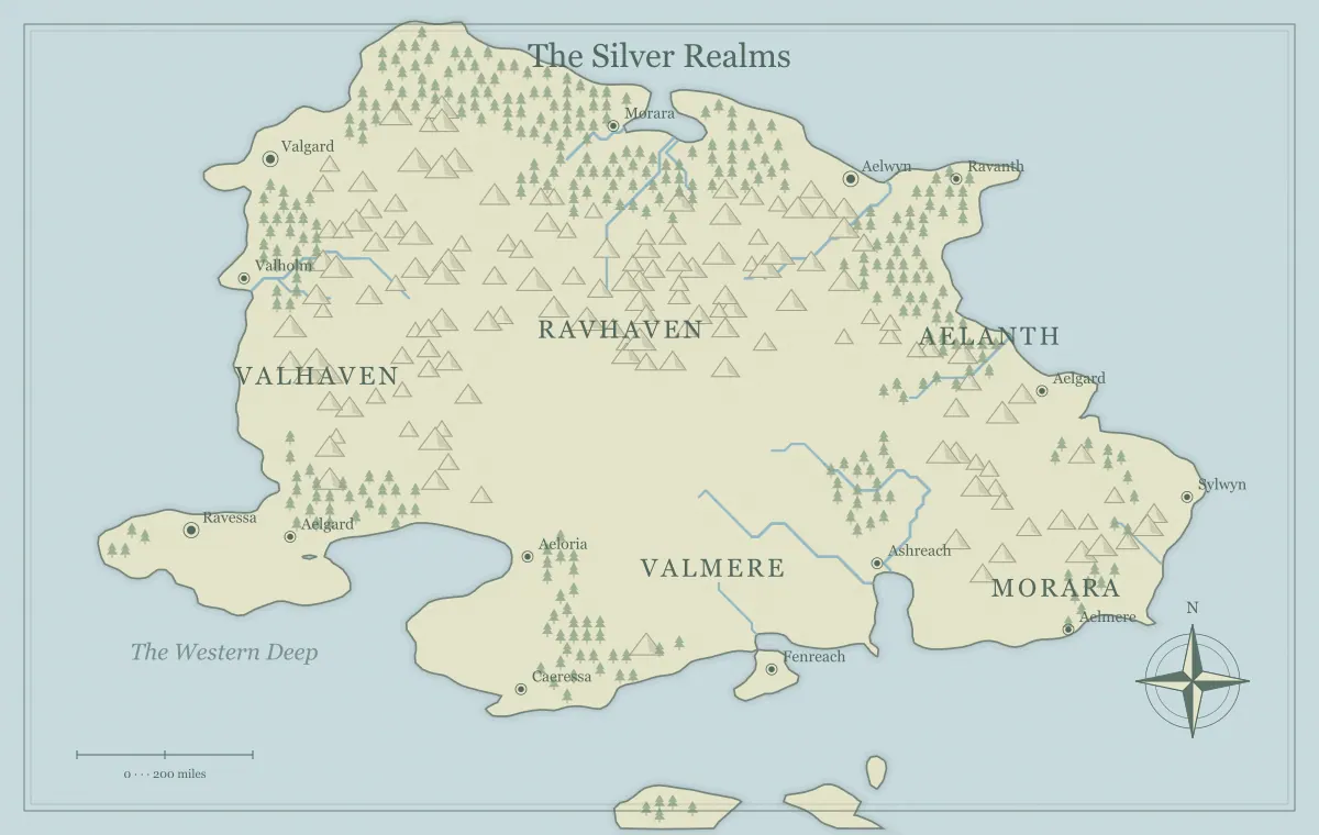
Travel on a campaign map becomes interesting when routes change what the characters can do, not merely how many days they spend moving. A road can offer reliable shelter but expose travelers to a patrol. A river can move goods efficiently but require a boat and a usable landing. A ridge path can be short on the image while demanding difficult terrain. These differences give players a reason to compare options and let the map support decisions rather than act as a decorative backdrop.
This guide uses an original fictional region called the Fenward Roadlands. You can build its overview with the DND world map maker, which is independent of tabletop game publishers. We will connect the home town of Fenward to a distant market through three possible routes. The focus is regional preparation and clear information, not a replacement for the travel procedures or rules your group chooses to use.
Define the reason for the journey
A route matters because someone wants to reach a destination. Start with the objective and the consequence of delay. The characters might carry medicine to the market town, seek a witness beyond the ridge, or escort a caravan before winter. That purpose tells you which route differences matter. A time-sensitive delivery makes speed important, while a covert mission makes visibility and checkpoints more important.
For Fenward, the objective is reaching Stone Market before an important negotiation ends. The group has several days, but arriving with evidence and allies may matter more than arriving first. This creates space for a route that offers information or relationships. The campaign world guide helps connect that objective to the starting town, competing interests, and a destination with a situation that can change.
Build a network, not a single line
Identify the home town, destination, and intermediate places that connect them. Fenward can reach Stone Market by the official road through Gatebridge, by the river to Reed Landing, or by a ridge path through an abandoned quarry. Each route has a different sequence of locations. The map should make those relationships understandable even if you describe parts of the network in accompanying notes rather than drawing every line.
A useful network includes some connections between routes. A traveler might leave the river at Reed Landing and join the road near Gatebridge. That crossover gives the group a response if conditions change. Without it, every initial choice becomes a rigid corridor. The sandbox map guide explains how connected places support flexible exploration, while city placement helps make the intermediate towns serve plausible functions.
Separate distance, effort, and elapsed time
Distance is the length of the journey in your fictional scale. Effort depends on terrain and transport. Elapsed time includes waiting, rest, weather, and stops. These are related but not identical. A river trip might cover a longer path with less carrying effort, while a short ridge route may take longer because the group moves slowly. Keep those distinctions visible in your preparation.
Use the travel system your group prefers and apply its assumptions consistently. Do not derive precise durations solely from the generator's illustrative scale bar. Establish the region's intended size and the ordinary travel conditions first. The scale and distance guide explains how to create a coherent fictional framework. If you present an estimated duration to players, state the assumptions that make it useful, such as ordinary weather and no major delay.
Give each route a clear tradeoff
Write a small route profile with advantages, costs, and uncertainty. The official road offers inns and clear directions, but passes through a checkpoint. The river offers efficient transport, but requires hiring a boat and waiting for safe conditions. The ridge path avoids the checkpoint, but lacks reliable shelter and has a difficult descent. These differences should affect the current objective, not merely add unrelated inconveniences.
Avoid making one route obviously superior in every respect unless that is the intended situation. If the road is fastest, safest, cheapest, and most informative, the choice may be trivial. Also avoid balancing routes as if every adventure needs an equal numerical score. Different groups value different things. Present enough information for them to make a judgment, then let their priorities determine which route is attractive.
Make route information obtainable
Players cannot make a meaningful comparison if all relevant facts are hidden. Put useful knowledge in the town, the map caption, or conversations with travelers. A ferryman can explain river conditions, an innkeeper can describe the checkpoint, and a quarry worker can discuss the ridge path. The group does not need perfect information, but it should have some basis for its initial choice.
Distinguish reliable facts from rumors. “The river requires a boat” is stable. “A patrol may have moved to Gatebridge” can remain uncertain. Keep that uncertainty explicit so a later discovery feels like new information rather than an arbitrary contradiction. The player and DM map guide provides a knowledge inventory for known, rumored, and private information. Use it to decide which route details belong on the handout.
Prepare situations at route locations
An intermediate place is more useful when something is happening there. Gatebridge might be inspecting goods after a theft. Reed Landing might have a damaged pier and a boat owner seeking help. The quarry might shelter travelers whose supplies are running low. These situations can become encounters, negotiations, or simply evidence about the region. They connect travel to the world rather than treating every mile as an empty interval.
Prepare what each group wants, what changes if nobody intervenes, and what the characters can learn. Do not require the players to resolve every location before continuing. A route choice should create opportunities and consequences, not a fixed series of compulsory scenes. The faction mapping guide helps tie situations to resources and control, and landmarks gives physical sites a useful history.
Use obstacles that follow from geography
Choose obstacles the landscape helps explain. A river crossing can be affected by high water. A pass can become difficult under snow or rockfall. A coastal route can depend on a safe landing and shelter. These obstacles make the map feel relevant because the characters could anticipate or investigate them. A completely unrelated surprise can still occur, but it should not be the only reason the journey matters.
For the Fenward river route, a damaged pier changes where passengers can unload, which adds an overland connection to the road. The obstacle creates a revised route instead of simply canceling the players' choice. If you change conditions during travel, communicate the evidence the characters can observe. The river guide and mountain guide offer major geographic relationships that can inform these consequences.
Connect supplies and shelter to the network
Decide where travelers can rest, obtain food, repair equipment, or change transport. You do not need detailed prices for every stop unless your campaign uses them. A simple note that the road has regular inns while the ridge has no settlement already distinguishes the routes. Supply locations also explain why towns exist and why factions care about particular crossings.
Keep the assumptions fair and visible. If the characters would know that a remote path lacks water, let them learn that before departure rather than presenting it as a hidden penalty. A guide or a map note can provide the warning. The frontier town guide connects settlement roles to service and supply, while trade routes explains how movement networks influence a wider fictional economy.
Keep the map useful without revealing every event
The player handout can show the main road, river, ridge, and known stops. Your private notes can contain the patrol's current plans, the quarry's concealed passage, or a faction's intended ambush. Do not place a private event marker on the player map simply because it helps your own preparation. Use a separate version or a location index for information the audience should not see yet.
Review the export rather than only the working screen. Titles, captions, and filenames can reveal route secrets as easily as labels. The audience version guide explains that audit, and the export guide covers the file itself. A clear public map should support route decisions while leaving room for discovery at the places the group chooses to visit.
Let route conditions change after play
Actions can alter the network. Repairing the pier can reopen the river route. Negotiating with the checkpoint authority can change the road's cost. Helping the quarry travelers can create a safe shelter on the ridge. These changes give players visible evidence that their decisions affect the region. Update the map or its notes when a change is important enough to influence later travel.
Keep the distinction between a world change and new knowledge. A hidden path becoming known does not mean it was physically created that day. A bridge being rebuilt does change the world. Record the difference so future versions remain coherent. The campaign maintenance guide provides a short update routine and explains how to retain earlier handouts without confusing them with the current approved version.
Use a small Fenward route note
A practical route note can say: the road has shelter and a checkpoint; the river needs a boat and a usable landing; the ridge avoids inspection but has no dependable shelter. Add the source of each fact and the conditions under which it may change. This is enough to support an initial comparison without publishing private encounter notes or calculating every mile before the campaign begins.
During play, record a change beside the affected route rather than replacing the whole note. If the characters repair Reed Landing, the river's unloading problem is resolved. If they secure a permit, the checkpoint becomes less uncertain for their next journey. The same geographic network now carries the consequences of their actions, giving later travel a recognizable connection to earlier choices.
Calculate a route with explicit assumptions
The fantasy travel calculator now turns a chosen distance, pace, terrain multiplier and daily travel hours into moving time. For example, 120 km at 4 km per hour on ordinary terrain takes 30 moving hours: three eight-hour travel days plus six hours. Set the values to match your campaign rather than treating that example as a game rule. Add ferry waits, exploration, weather and encounters separately. The calculator does not read distances from the generated map or determine a geographic scale for it.
Prepare enough for the next decision
Before the session, summarize the routes in a few lines: where they go, what makes them attractive, what they cost, and what is uncertain. Prepare the important intermediate situations and a response if the group changes routes. You do not need a separate encounter for every visible bend. Focus effort where the map supports a choice or where a consequence is likely to matter.
A useful DND travel map lets the group discuss Fenward, Gatebridge, Reed Landing, and the ridge as connected places with distinct opportunities. The journey can then reflect their priorities instead of serving as a fixed delay between adventures. Clear geography, obtainable information, and changing conditions make routes worth considering. The map becomes a record of choices the campaign can remember, not just a picture of how far the characters walked.
Give the idea a world of its own.
Try the technique in the generator, then save an editable copy so you can return to your work.
Open the map maker ↗