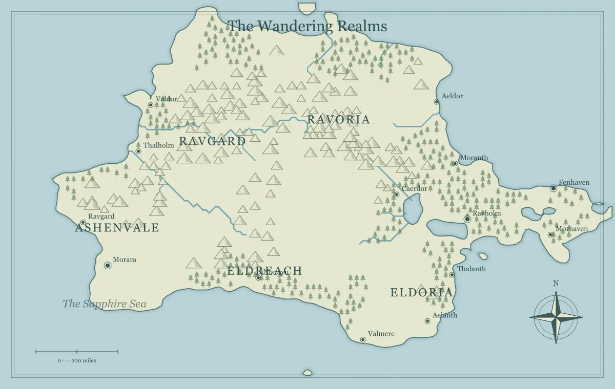
Rivers can organize a fantasy world because they connect terrain, settlement, movement, and conflict. A river is not merely a blue line filling an empty region. It belongs to a drainage system, creates crossings, and can influence where people gather. In a story, the same waterway might carry grain, separate two administrations, and provide an alternative to a damaged road. Thinking about those relationships makes a generated map more useful without requiring a complete hydrological simulation.
This guide develops an original region called the Clearwater Vale with the fantasy map maker. The generator supplies fictional terrain and river drawing, while you interpret the geography for your setting. We will review the broad drainage, choose settlements and crossings, and distinguish a geographic overview from precise claims about water or travel. The browser controls do not provide unrestricted point-by-point river redrawing, so detailed custom geometry may require an external vector workflow.
Begin with the watershed idea
A watershed is the area contributing water toward a common drainage outlet, and ridges can separate neighboring drainage areas. This is a useful way to read river relationships rather than judging each line alone. The USGS watersheds and drainage basins guide explains the real-world concept. For fiction, use it as a broad reasoning aid rather than claiming that your generated illustration is a surveyed model.
On the Clearwater map, identify the high ground, the valley, and the outlet toward the coast. Then ask which settlements belong to that connected system. A town downstream can depend on events upstream even if the places are separated politically. Keep the system's main relationships in your notebook. You do not need to name every minor stream before the largest drainage connection becomes useful to the story.
Read rivers together with hills and valleys
Inspect the broad terrain around the main river. A route that appears to cross a high ridge without explanation may need a different interpretation or a revised map. The generated artwork is not a detailed elevation survey, so avoid treating every mountain symbol as a measured peak or every blank area as perfectly flat land. Read the illustration at the level of its purpose.
For Clearwater, the ridge helps frame the valley and the road follows the lower corridor. If your story needs a surprising water feature, establish the cause: a constructed channel, unusual geology, or consistent magical infrastructure. Do not use an unexplained exception merely to avoid thinking about the relationship. The mountain guide connects barriers and passes to movement, while magical geography helps give exceptions coherent rules.
Choose which part of the river matters at this scale
A regional overview needs a clear main waterway more than exhaustive detail. Decide which river connects the story's important places and give it a recognizable name. Smaller tributaries can remain secondary unless they explain a destination or boundary. Too many equally emphasized names can make the network harder to understand, especially on a printed handout or phone-sized image.
In Clearwater Vale, the main river connects the upland market, a ferry town, and the coastal port. A tributary leads toward a quarry settlement that becomes relevant later. The first handout can name the main river and three public places, leaving the tributary's detailed history in the notes. The label guide explains hierarchy, and naming helps keep river and town labels distinct.
Give the outlet a relationship to the wider map
Identify where the main river reaches its destination in your chosen frame. The outlet may connect to a coast, a lake, or a larger waterway beyond the visible region. If the map cuts off before the outlet, say so in your notes instead of assuming the river ends at the image edge. The overview is a view of the setting, not necessarily the whole system.
For Clearwater, the coastal port handles goods arriving from the valley. That relationship connects inland places to sea routes and creates a reason for the port to exist. Avoid assuming that every river mouth is automatically suitable for every kind of shipping. Local conditions and infrastructure remain fictional decisions you must establish. The coastline guide explores bays, river mouths, and coastal settlements as connected parts of a region.
Treat crossings as locations with a purpose
A bridge, ferry, or usable ford can concentrate movement and explain a settlement. Choose which crossing the audience needs to understand first. Clearwater's ferry town exists where the valley road meets the river. Its landing, repair service, and storage yard follow from that function. The crossing can become important through a delay, fee dispute, or need for maintenance rather than requiring a monster at every river scene.
Record alternatives if the main crossing is unavailable. A longer route may reach a bridge, while a seasonal crossing may require local advice. This gives a problem consequences without making the map a single blocked corridor. The travel route guide develops meaningful alternatives, and frontier town design connects a crossing to services and practical dependencies.
Place settlements through water and movement
Water access can support a town, but it is not the only factor. A settlement also needs food, resources, routes, or another reason for people to remain. Clearwater's upland market collects goods from the valley, the ferry town connects travelers, and the port exchanges cargo with the coast. Their different roles make the river network feel inhabited rather than dotted with interchangeable names.
Ask what each place receives and sends onward. The ferry town may need timber for boats, while the market needs tools brought from the port. These dependencies can become story situations. The city placement guide examines settlement factors in more detail, and trade routes connects them into an economy at a useful fictional level without demanding a complete numerical model.
Do not equate a river line with unrestricted navigation
A drawn river does not establish its depth, speed, obstacles, or suitability for a particular vessel. Decide the navigable portion that matters to your setting and describe the assumptions. Perhaps cargo boats travel between the port and ferry town, while smaller craft or overland routes handle the upper valley. That choice creates a transport network instead of a promise that one boat can reach every visible tributary.
Also distinguish travel in different directions and under different conditions when relevant to the campaign. Use your chosen game procedures or story assumptions consistently. A river route can be attractive for moving goods while still requiring a landing and skilled crew. The scale guide separates distance from effort and time. Keep exact travel claims in your notes only when you have established the fictional framework that supports them.
Use changing conditions coherently
River conditions can change because the contributing system changes, not only because rain falls beside a particular town. The USGS streamflow overview discusses the connection between rainfall and river flow. For a fictional setting, decide which changes are important to the current situation and communicate evidence that residents or travelers could observe.
A damaged landing can interrupt unloading, a high-water period can affect crossing plans, and a dry season can change supply concerns. These are useful story conditions when they follow established geography and information. Avoid using them only as arbitrary penalties after the audience chooses a route. Give locals knowledge and practical responses, such as an alternative landing or a delay that changes the group's priorities.
Separate the waterway from political claims
A river can be used as a boundary, but the physical waterway and political agreement are different things. A realm might claim one bank while a ferry association operates across both. Villages on opposite sides can share markets and families despite the formal line. Decide what changes at the crossing: fees, law, authority, or simply the map's administrative label.
Do not make every river a border merely because it is convenient to draw. Some waterways connect communities more strongly than they separate them. The border guide explores that distinction, and faction mapping connects control to assets and services. A clear caption can prevent a reader from treating every blue line as a political barrier.
Give river places a changing history
A former landing, ruined bridge, or old mill can reveal how the region used to work. The site should have a relationship to the water and movement network. An abandoned warehouse beside an old route can suggest a trade shift. A rebuilt ferry can record a recent campaign event. These details make history visible through places rather than requiring long explanations beside every label.
Choose one historical change relevant to your project and record what remains. Clearwater's old bridge might have been replaced by a ferry after damage, leaving a road that still points toward the earlier crossing. The landmark guide helps connect past function to present situations. Keep local detail in notes or a closer view so the regional image stays readable.
Revise within the tool's actual controls
The generator provides settings and supported label or landmark edits, not unrestricted river path drawing in the browser. If the water network does not support the story, choose another candidate or revise the geographic premise before investing heavily in names. If you need a particular channel geometry, an exported SVG can become material for a suitable external workflow. Preserve the edited source separately.
The tool limits guide explains the boundary between procedural illustration and complete custom mapping. The iteration guide helps diagnose whether the problem is structural or local. A crowded river label needs a different correction from a waterway that does not connect the places required by the brief.
Review Clearwater as a connected system
Before export, identify the major drainage relationship, the important crossing, the three settlement roles, and the route conditions the audience should know. Save the editable file and inspect the actual downloaded image at its intended size. The export guide covers format and readability checks. River lines and nearby labels should remain distinguishable without close magnification.
A believable fantasy river network is useful because it supports a coherent setting, not because it imitates every detail of real hydrology. Clearwater connects people, goods, history, and choices through one understandable system. The generated artwork gives you a starting arrangement; your notes establish the practical relationships and exceptions. Keep those decisions consistent, and the river can become one of the strongest organizing features of the world.
Give the idea a world of its own.
Try the technique in the generator, then save an editable copy so you can return to your work.
Open the map maker ↗