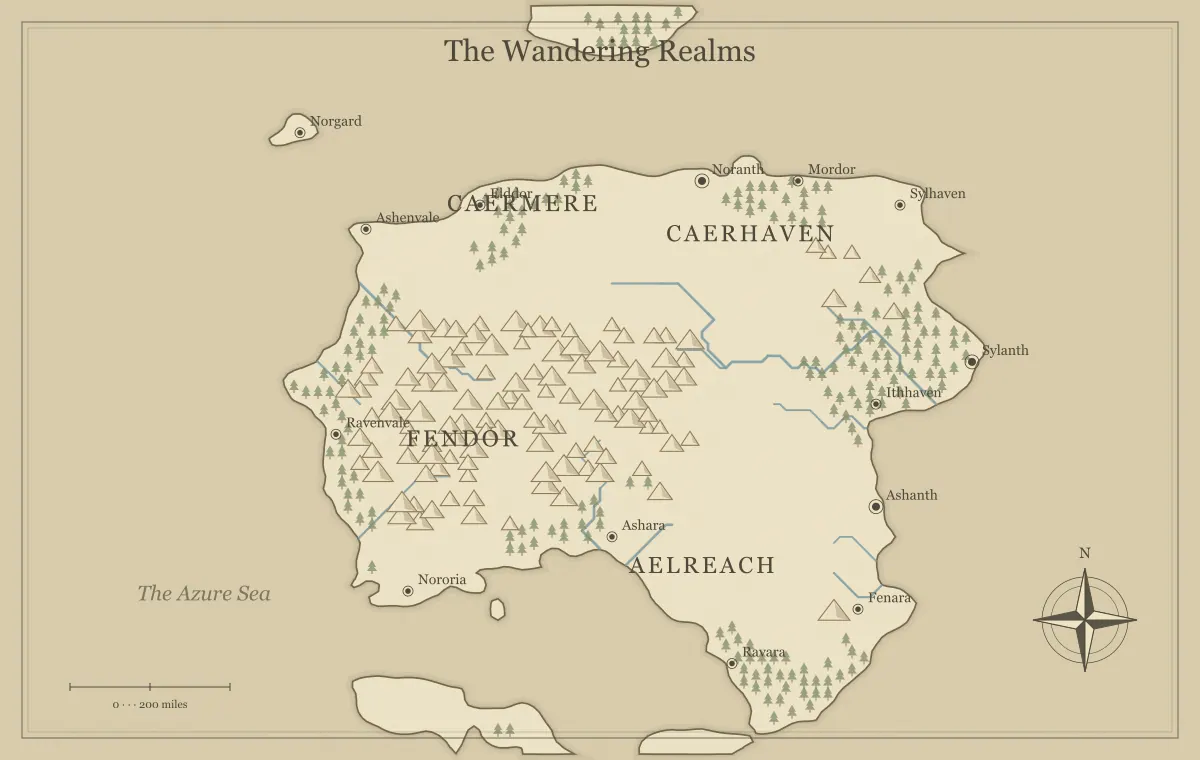
A fantasy map maker can help a novelist connect places, travel, and consequences before the setting becomes difficult to track. The most useful map is not necessarily the most elaborate world overview. It is the view that answers the questions your draft raises: where the character begins, what separates them from a destination, which route changes their choices, and what the reader needs to understand. A map can support both private planning and a public illustration, but those versions may contain different information.
This guide develops an original novel setting called the Grey Orchard using the fantasy map maker. A messenger leaves a river town to reach a coastal archive before an important record is removed. We will use the geography to organize decisions and continuity without assuming that generated terrain writes the plot. The tool provides fictional illustration; your draft establishes the characters, viewpoint, and events that make the places matter.
Begin with a question from the draft
Choose a concrete problem that the map can answer. The messenger needs two plausible routes to the archive, and the choice should affect whom they meet. That question requires a starting town, destination, barrier, and connection network. It does not yet require a complete political history for every continent. Write the question beside the working file so geography remains tied to the story's current needs.
Other useful questions include whether two scenes can occur within the established timeline, why a settlement depends on another region, or what a character knows about a distant place. The mapmaking workflow turns a brief into staged decisions. The journey guide connects route choices to narrative consequences rather than treating travel as an empty interval between chapters.
Choose a planning scope you can maintain
The Grey Orchard draft needs one river region and its coastal connection. A regional map keeps the important places readable and leaves room for local relationships. A world overview may become useful later if the novel expands. You can maintain both views, provided you record which facts and major landmarks must remain consistent across them.
The current generator does not automatically produce an exact matching close-up of every world map. If precise continuity between scales is essential, use a workflow that preserves the needed geometry or reconcile a regional interpretation deliberately. The map type guide helps select scope, while tool limits explains what procedural illustration can and cannot promise.
Select places through narrative function
Give the main locations different roles. The river town is the messenger's home and source of the assignment. The ridge settlement offers an alternative contact. The coastal archive holds the record and has its own current pressure. These functions explain why the character might visit each place. An additional town should answer a useful question rather than exist only because a generated label appears there.
Write a short note for each important place: what the character wants there, what complicates the attempt, and what can change. Keep detailed scenes in the manuscript or scene outline. The map becomes an orientation index rather than a container for every plot note. The city placement guide connects a town's narrative role to water, resources, and movement.
Let routes change the available choices
The direct road passes through a checkpoint and reliable lodging. The river route depends on a boat and a usable landing. A ridge trail connects to someone who may help but requires more local guidance. The choice can reflect the messenger's priorities, knowledge, and relationships. Do not make every path lead through the same compulsory scene merely to preserve an outline that no longer fits the geography.
Record what the character knows when choosing and what they learn afterward. An informed choice can still have an unexpected consequence. The travel route guide offers a useful framework for alternatives even outside tabletop play. The scale guide separates route length from elapsed time, which helps keep the novel's timeline coherent.
Use the map to test the timeline
Track one or two important journeys through the same distance and travel assumptions. A character who reaches the coast unusually quickly needs a reason established in the story, such as a different transport method or route. A delay can arise from waiting, investigation, or conditions without changing the underlying distance. Keep those causes explicit in your planning notes.
You do not need exact travel calculations for every scene. Use precision where it affects the plot, and broad descriptions elsewhere. If the story needs an arrival before a deadline, check the assumptions carefully. The map should reveal a continuity problem early enough to revise the draft or geography deliberately, rather than force unsupported timing into a later chapter.
Connect the setting through ordinary dependencies
The coastal archive needs paper, food, staff, and routes for visitors or messages. The river town sends goods downstream and receives tools from the coast. These practical relationships can make the setting feel inhabited beyond the protagonist's journey. Choose the dependencies that affect scenes or institutions rather than creating a full numerical economy that the novel never uses.
A disrupted route can then have recognizable consequences. The archive may restrict access during a supply problem, or the river town may depend on a repair service elsewhere. The trade guide develops these connections, and climate planning helps keep broad environmental assumptions coherent. Geography becomes part of the setting's causality rather than background decoration.
Separate the author's map from the character's knowledge
Your planning map can contain the full route network and concealed places. The messenger may know only the public road and a rumored trail. Keep that difference in the notes so the narration does not reveal information the viewpoint character lacks. A location can exist on the author's reference without appearing on the public illustration at the front of the book.
The audience version guide applies well to author and reader views. Mark known, rumored, and private information, then decide what belongs in each artifact. The hidden realm guide distinguishes unknown, concealed, and inaccessible places. Those categories help preserve discovery without making the world's physical facts change whenever a viewpoint changes.
Review the public map for unintended reveals
A named destination, unusual marker, or title can expose a late story development. Decide what a reader should know when opening the book. A public map might show broad regions and early destinations while omitting a concealed archive annex. Removing a label is not enough if a distinctive icon still points directly to the secret site.
Also review the caption, filename, and surrounding layout. A spoiler can appear outside the image itself. Keep a separate approved public export and label the author reference clearly. The final review guide includes delivery context, and the export guide explains the actual file checks. Review what the reader receives, not only what looks safe in the editor.
Maintain names across map and manuscript
Keep a name register with the map label, feature type, aliases, and any pronunciation note you need. The Grey Orchard is a region, Reedgate is the home town, and Salt Archive is the destination. Their distinct scopes and spoken forms help readers follow the setting. If you rename a place, update the manuscript references, map, and planning notes together.
Generated names are suggestions rather than verified translations or exclusive names. Adapt them to your intended culture and readability. The naming guide supports a consistent system, and name generation offers material you can test. A short clear map label can coexist with a longer formal title in the story when the relationship is recorded.
Use maps during revision with a focused question
When revising, ask the map a particular question: does the new scene require another route, does a changed settlement role affect supply, or does the timeline still work? Avoid regenerating the whole world merely because one label feels awkward. Save a baseline before major changes and preserve the useful relationships already established in the draft.
The iteration guide separates structural changes from local corrections. A moved label can improve readability, while a changed coastline may require manuscript revisions. Record why a map version changed so you can distinguish a visual improvement from an alteration to the fictional facts. This protects continuity when the story develops over several drafts.
Prepare the illustration for its actual placement
A map intended for a printed book should be tested at the planned physical size. Small names and thin lines can become difficult even when a large editor preview looks clear. A monochrome version may be more useful for a particular interior layout. An online companion page may use a different export while preserving the same approved geography and names.
The print guide connects image dimensions to placement, and monochrome printing helps preserve hierarchy. Check the receiving application and publication requirements directly. The generator's original map output can support creative projects under the site's terms, while rights in any outside material you add remain a separate responsibility.
Keep a recoverable reference archive
Save the editable JSON, the approved image, and the name register together. If you make external SVG changes, preserve that edited source too. The generator's saved state will not automatically recreate every adjustment made in another application. Browser storage is convenient for recent work but should not be the only copy of a setting you use throughout a manuscript.
The saving guide provides a recovery check. Give versions a clear purpose, such as author-reference-v4 or reader-map-v2. The notebook guide organizes facts, possibilities, and unresolved questions. A small reliable archive is more useful than many ambiguously named images that disagree about the world's current state.
Test the Grey Orchard through one chapter
Choose a chapter involving movement or a location change. Identify what the protagonist knows, the route they choose, the conditions that affect it, and the consequence at the destination. Then check the map and timeline against that sequence. If the chapter needs a different relationship, revise it deliberately rather than adding unexplained geography only to bridge a gap.
A fantasy map maker helps a novel when it supports coherent choices and continuity. The Grey Orchard becomes useful through connected places, believable dependencies, clear names, and controlled viewpoint information. The map does not need to contain every idea in the setting. It needs to answer the draft's important questions and remain a reliable reference as the story grows.
Give the idea a world of its own.
Try the technique in the generator, then save an editable copy so you can return to your work.
Open the map maker ↗