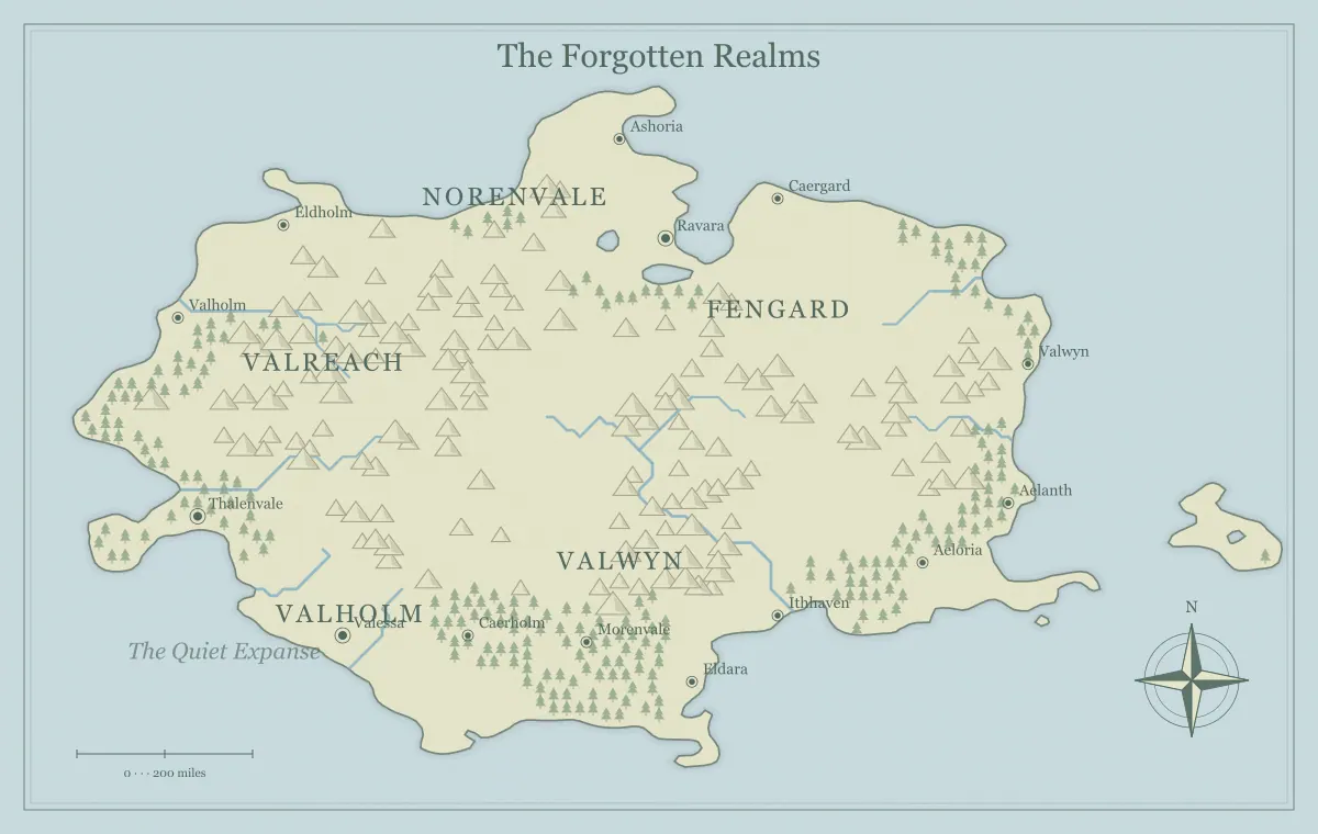
A sandbox campaign map gives players several meaningful directions without requiring the game master to prepare every square mile. The useful part is not simply the amount of blank space. It is the network of places, information, and situations that lets the group choose where to act. A large landscape with one obvious destination can still function like a corridor. A small region with connected locations and changing interests can support a flexible campaign for many sessions.
This guide develops an original setting called the Willow March using the DND world map maker. The tool provides regional geography and is independent of tabletop game publishers. We will create a starting town, several nearby destinations, connections between them, and a lightweight maintenance routine. The goal is a map that supports choices you can respond to, rather than a promise that every possible destination has already been written in full.
Start with a stable center
The starting settlement gives players a place to return, compare information, and decide what matters next. Willowford sits at a river crossing where travelers, farmers, and boat crews meet. Its role makes information available naturally. A damaged upstream bridge, a disputed ridge path, and a missing island ferry can all become subjects of conversation there without requiring three unrelated quest notices.
Give the center useful services and current concerns. It can provide shelter, repairs, and introductions while depending on routes the campaign may change. The town need not be perfectly safe, but its function should be understandable. The frontier town guide explains how resources and movement support settlement identity, and city placement helps choose a location that fits the geography.
Prepare several distinct nearby destinations
Select three or four places with different opportunities. The Willow March has a flooded mill, a ridge shrine, an old ferry island, and a quarry settlement. The mill concerns food supply. The shrine concerns a disputed road. The island concerns river traffic. The quarry concerns labor and building material. Their roles give the group reasons to choose beyond the appearance of their markers.
For each destination, prepare a short situation: who is there, what they want, what is changing, and what the characters can learn. You do not need a complete dungeon for every marker before the first session. A location can begin as a social situation, a travel problem, or a lead toward later exploration. The ruins and landmarks guide helps connect physical places to history without making every old structure an identical adventure site.
Connect locations to one another
A sandbox becomes more flexible when destinations share relationships. The quarry needs the ridge road to ship stone. The ferry island carries grain from the mill. The shrine's keepers influence travelers approaching the quarry. These connections mean that visiting one place can reveal information about another. The group can change direction based on what it learns rather than choosing from isolated tasks that never interact.
Record the connections as a small network in your notes. On the map, make the geographic relationships clear through rivers, barriers, and major settlement placement. You can describe routes in accompanying text if the image does not show every connection. The travel route guide explains how alternative paths support choice and how crossovers let players respond when conditions change after departure.
Make the alternatives genuinely different
Each destination should offer a different question or cost. The flooded mill may be urgent and close. The quarry may offer valuable allies but require negotiation. The shrine may provide answers about the region's history. The ferry island may open a transport route. Do not make one option superior in every respect unless you intend the others to serve a different purpose, such as background context or a later opportunity.
Also avoid requiring the same hidden solution at every location. If all roads lead to one compulsory revelation, the geography may offer only the appearance of freedom. You can have a central campaign theme while allowing several ways to engage with it. Prepare situations and consequences more than a fixed sequence of outcomes. The map should show possibilities the players can interpret, not disguise a predetermined order behind several differently named towns.
Put useful leads where players can obtain them
A choice is meaningful when the group has enough information to compare it. Willowford can provide reports from boat crews, a quarry representative, and a traveler returning from the shrine. Each source can describe something useful without revealing every detail. Give the players a reason to believe the flooded mill is urgent and the quarry dispute is political, so they are choosing according to priorities rather than selecting a random marker.
Keep rumors distinguishable from confirmed facts. A source may know the ferry stopped operating but only speculate about why. The player handout can show the island while the explanation remains uncertain. The player and DM map guide provides a knowledge inventory for known, rumored, and private information. That inventory helps you give enough orientation while preserving discovery at the destination.
Give factions interests that cross the map
Factions make a region feel active when their goals involve several locations. The river association wants reliable ferries and grain traffic. The quarry owners want the ridge road reopened. The shrine keepers want travelers to respect a disputed boundary. Their interests overlap without requiring every group to control a neatly separated territory. A decision at the mill can affect negotiations at the quarry through supply and transport.
Prepare a present goal and likely next action for each important group. Keep their motives comprehensible even when players disagree with them. You can then respond to intervention without inventing a new agenda every session. The faction mapping guide explains how influence, ownership, and practical control differ. A regional map can support those distinctions through places and routes rather than filling the image with many hard borders.
Decide what changes if nobody intervenes
A sandbox feels alive when situations continue outside the players' immediate attention. The damaged mill may lose another shipment. The quarry may hire a private escort. The shrine may close its guest shelter. These developments should follow from established interests and conditions. They are not punishments for choosing the wrong adventure; they are evidence that the world contains other people acting for understandable reasons.
Track only the developments likely to affect the next few sessions. A short note with the current state and possible next change is enough. Avoid a complicated calendar of dozens of unseen events if it makes preparation harder without improving play. When a development becomes visible, communicate it through travelers, prices, changed routes, or a revised handout. The between-session guide helps maintain this record without rewriting the entire region.
Leave space with a clear purpose
Unlabeled terrain is useful room for later questions, new character interests, and unexpected destinations. It does not have to mean that nothing exists there. The western woods of the Willow March can remain a broad geographic feature until the group seeks a missing hunter or a hidden route. When that need appears, develop a location consistent with the geography and the information already established.
Keep a few provisional ideas in the notebook rather than publishing all of them as fixed facts. This protects flexibility without making the world arbitrary. If players travel into a blank area, offer plausible features and signals of what they can investigate. The notebook guide explains how to distinguish approved facts, possibilities, and unresolved questions across a growing setting.
Prepare to the depth of the next decision
Before a session, review the likely destinations and prepare enough material to respond if the group chooses them. Some places may need only a situation and a few names; another may need a local encounter layout. A regional geographic map does not replace that smaller-scale preparation. Use it as an index to the places you have prepared and as a frame for travel between them.
Ask the group about intended directions when that fits your table's practice. Their plans can guide preparation without forcing them to follow the plan rigidly. Keep alternative situations simple enough to adapt if they change course. The no-login preparation guide demonstrates a small playable region, while the tool's limits separates regional illustrations from tactical room or encounter mapping.
Give the players a readable overview
The first handout should emphasize Willowford, the main river, the ridge, and the known destinations. Avoid crowding it with every private preparation marker. Use distinct place names that the group can say and find quickly. If several important sites have similar labels, rename one or give it an obvious common nickname. The map needs to work in conversation, not only as a large image on your own screen.
Export a player version and inspect the actual file. Keep private information in a separate version or notebook. The naming guide supports memorable labels, and the export guide covers print and screen checks. A good handout makes the network understandable while leaving room for players to ask questions and discover what the locations contain.
A first-session preparation snapshot
For the first Willow March session, prepare Willowford's three information sources and the situations at the mill and quarry. Keep the shrine and ferry island as short location notes with enough information to answer initial questions. If the group chooses the shrine, use its current dispute and visible geography to begin play rather than inventing a complete unrelated dungeon. Their choice can then tell you what needs deeper preparation before the next session.
Afterward, write one line for each changed connection. Perhaps the quarry now offers transport toward the mill, or a shrine contact reveals a safer ridge path. This turns the network into a living record of the group’s actions. It also keeps preparation centered on what they actually engaged with instead of expanding every unvisited destination equally.
Maintain consequences and connections
After play, record which places the group visited, what changed, and which new leads became available. Update the relevant map version when a change affects orientation or known routes. A repaired ferry may open a connection; a faction agreement may alter who operates the quarry road. Keep a saved editable file before major changes and retain the earlier approved handout when it documents the campaign's history.
A sandbox map succeeds when players can see several meaningful possibilities and the region responds coherently to their choices. The Willow March does not need hundreds of prepared sites. It needs a stable center, distinct nearby situations, understandable connections, useful information, and consequences that continue over time. Those elements let a modest fantasy map become a shared world the group can influence instead of a large picture they merely pass through.
Give the idea a world of its own.
Try the technique in the generator, then save an editable copy so you can return to your work.
Open the map maker ↗