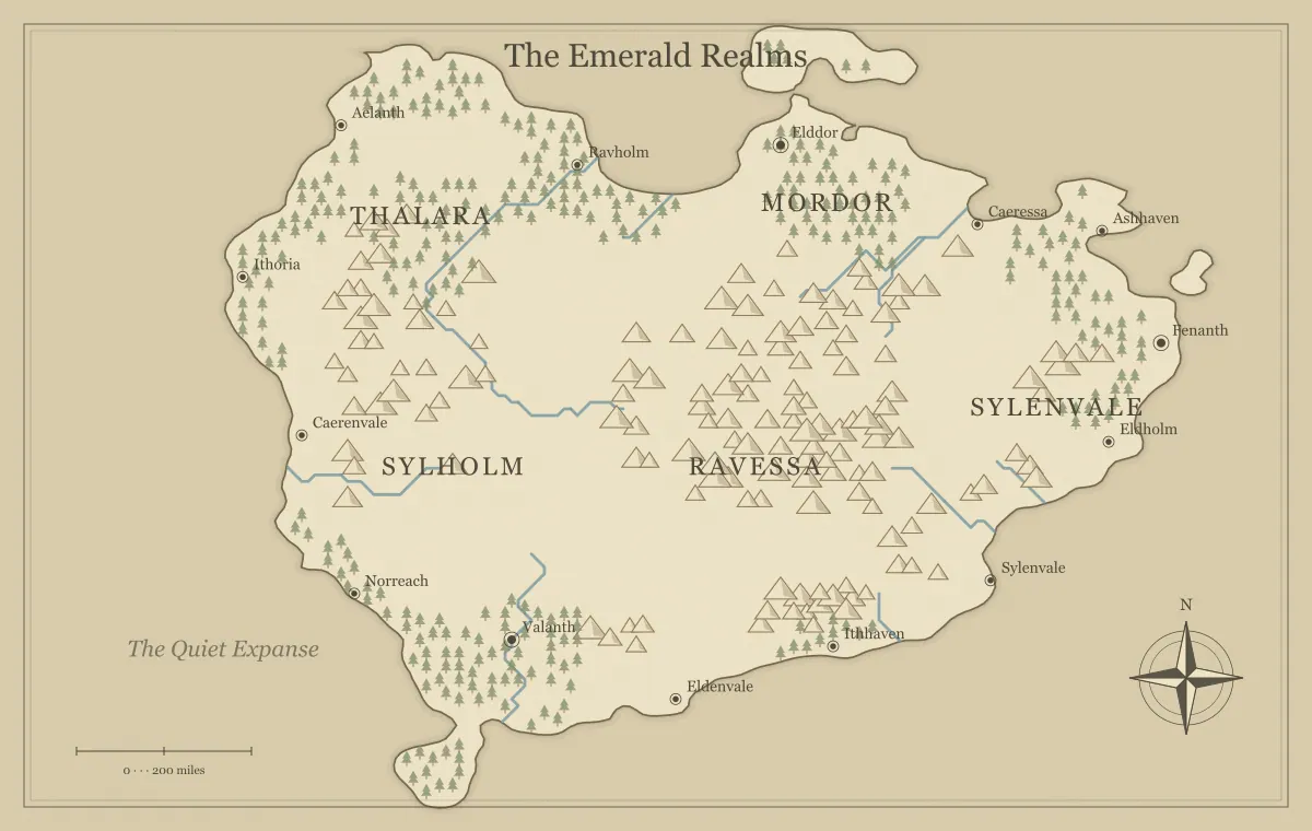
A frontier town becomes useful in a fantasy campaign when its location explains both opportunity and difficulty. It might stand at a river crossing, beside a new mine, or near the last reliable road before a rough upland. That position gives people reasons to arrive, stay, and disagree. A dot labeled “frontier town” does not create those relationships by itself. The map and your notes need to show what connects the settlement to the surrounding world.
This guide develops an original town called Alder Crossing using a region from the DND world map maker. The generator is independent of tabletop game publishers and provides fictional geographic illustrations rather than a street-by-street town plan. We will decide why Alder Crossing exists, what supports it, and which nearby places create adventures. The resulting overview can become a player handout while a separate notebook holds local scenes and private preparation.
Choose a specific reason for the town to exist
Start with one primary function. Alder Crossing operates a ferry where an inland road meets a broad river. Travelers, livestock, and goods pass through it because the crossing saves a long detour. A repair yard, warehouses, and lodging follow naturally from that function. You can add another industry later, but the first reason should be clear enough to explain why people built a settlement here instead of elsewhere.
Compare that function with the map. A mining settlement needs a relationship with the resource and a way to move its output. A fishing port needs a usable coastal connection. A garrison town needs supplies and a route worth guarding. If the chosen terrain does not support the function, revise the concept or select another site. The city placement guide examines water, resources, movement, and defensible positions in more detail.
Define what the frontier means
A frontier is not automatically empty land waiting for settlers. It can be the uncertain edge of an administration, a zone of overlapping authority, or a place where reliable routes become scarce. Decide which meaning fits your setting. Around Alder Crossing, the regional council maintains the southern road, while northern villages use older local agreements. The frontier is a change in authority and infrastructure, not the absence of people.
That definition affects the map and the stories you tell. An unexplored area may be unfamiliar to the characters while well known to its residents. Avoid treating a missing label on their chart as proof that nobody lives there. The borders and frontiers guide distinguishes claims from practical control, and faction mapping shows how several groups can influence the same route without occupying separate colored blocks.
Identify water and ordinary daily needs
The river gives Alder Crossing transport, but the settlement also needs dependable drinking water and food. Decide whether residents use protected wells, a spring, or another established supply. Keep the level of detail appropriate to the campaign. A short note about the water source can matter when a flood, drought, or damaged channel creates a problem. It also helps the settlement feel like a place people inhabit between adventures.
Think about what the town can produce locally and what it must receive from elsewhere. Nearby farms may supply grain while iron tools arrive along the southern road. That dependency creates useful connections to other places. You do not need a full economic calculation to establish them. The river guide helps connect the crossing to its wider drainage and travel context, while your fictional notes supply the specific infrastructure.
Place the town in a route network
Alder Crossing connects the southern road, the ferry, and a northern track toward wooded uplands. Each route has a different reliability. The road has regular traffic and official maintenance. The ferry depends on water conditions and working boats. The northern track has local guides and fewer services. Those differences let players compare approaches to nearby problems instead of seeing the settlement as an isolated starting point.
Identify an alternative if the primary connection fails. An upstream ford might be seasonal, or a longer road might reach a bridge. This gives a damaged ferry consequences without making movement impossible. The travel route guide explains how costs, uncertainty, and information create meaningful options. Show the important geographic relationships on the overview and keep detailed route conditions in the notes you use during play.
Give the settlement a few useful services
Choose services that follow from the town's function. Alder Crossing can repair wagons, store cargo, and arrange passage. A traveler might find lodging and local information but not every specialized item available in a large city. These limits can encourage journeys elsewhere without turning ordinary preparation into a constant obstacle. Decide which services are reliable and which depend on particular people or supplies.
For each service likely to enter play, write one name and one current concern. The boat repairer lacks a shipment of timber. The warehouse keeper is negotiating with local farmers. The innkeeper hears conflicting reports from the northern track. These people make geographic dependencies visible through conversation. Keep their roles distinct so the group can remember who helps with what, rather than preparing a long list of interchangeable shopkeepers.
Prepare nearby places with different roles
Select three nearby locations that relate to the town. Alder Crossing depends on a timber camp, an upstream village, and a ridge watch station. The camp supplies repairs, the village knows water conditions, and the watch station monitors the road. Each can provide a lead or develop a problem that affects the settlement. Their map positions should make those relationships understandable.
Give each location a current situation rather than only a historical description. The timber camp may have lost access to a trail. The upstream village may be disputing ferry fees. The watch station may be short of supplies. The sandbox map guide connects several destinations into a flexible network, while landmark design helps if one location is abandoned or has a history the characters can investigate.
Separate authority from influence
The regional council can issue rules, but it may not control every practical service. A ferry association operates the boats. Local families own much of the nearby farmland. A road patrol controls one checkpoint. These groups can cooperate or disagree without any one of them governing the entire region. Decide who can actually carry out a decision, not only who claims the right to make it.
Write one present goal for each important group. The council wants predictable fees, the ferry association wants safe operating conditions, and the farmers want affordable passage for goods. Those goals create tensions players can understand. The map can locate the relevant services and routes, while the notebook records agreements and disputes. A frontier town feels more convincing when power is connected to specific places and resources rather than described only through abstract titles.
Choose one pressure that reveals the town's dependencies
A current pressure gives the setting motion. In Alder Crossing, a damaged landing makes ferry loading difficult, and the timber needed for repairs has not arrived. This links the crossing, road, and camp in one situation. The characters can investigate the missing shipment, arrange another source, negotiate help, or find a temporary route. Several responses can improve the town without requiring one fixed solution.
Keep the consequence visible. Delayed traffic may fill the inn, raise storage costs, or leave farmers waiting with produce. These details explain urgency without a long speech. If nobody intervenes, decide what the town's groups attempt next. The campaign world guide uses a similar starting problem, and campaign maintenance helps track consequences after the players act.
Decide what the player map knows
The public handout can show Alder Crossing, the major river, the southern road's direction, and known nearby settlements. It need not reveal the location of a concealed trail or the private plans of a faction. Treat the handout as a viewpoint: perhaps it is a recent merchant chart that emphasizes useful routes. This explains why some details appear while others remain absent or uncertain.
Keep private preparation in a separate version or location index. Review symbols as well as words, since a marker can reveal a concealed place even without a name. The player and DM guide provides a knowledge inventory and release check. An informative public map helps players choose; secrecy should protect discoveries rather than remove every fact they need to understand the region.
Use names that support table conversation
The town name should be easy to distinguish from its neighbors. Alder Crossing, Reedbank, and Grey Watch have different beginnings and clear spoken forms. If every nearby place begins with Alder, players may confuse them during a busy scene. Shared roots can express history, but clarity remains important on the main regional handout. Keep ceremonial titles and detailed origins in the notebook.
Check label placement at the intended viewing size. The town should stand apart from the river line and nearby terrain symbols. A larger realm name should not obscure the crossing. The naming guide supports consistent place names, while label typography covers hierarchy and local edits. A readable settlement label does more for the first session than several additional unnamed decorative features.
Keep the regional map separate from local layouts
The overview explains where Alder Crossing sits and how people reach it. A local sketch can show the quay, warehouse, inn, and repair yard when a scene needs that detail. A tactical encounter may require another layout with precise positions. These are different artifacts. Do not enlarge the regional illustration and assume it will automatically become a measured street plan.
Maintain shared facts across the views: the quay faces the river, the road approaches from the south, and the repair yard lies near cargo handling. The tool limits guide explains why the generator is useful for fictional geography without replacing every mapping scale. Keep the regional map as the orientation index and prepare smaller views only when they serve actual scenes.
Turn the town into a playable starting point
The settlement generator can produce a village, town or city with a fictional population, livelihood, landmark and story hook. Choose Frontier for Alder Crossing, then compare the suggested livelihood with the ferry crossing described in this guide. Keep the ferry economy when a suggestion contradicts the geography; adapt the hook to the people already in your notes. Copy or download the result and add two NPCs who disagree about it. The tool provides preparation prompts, not a street plan or population simulation.
Let the frontier town change through play
After the group helps repair the landing or opens another timber route, record the change. Update the map if a new connection or important known location appears. Keep a saved editable file before major revisions and retain the earlier player handout when it documents the campaign's history. The settlement's growth can follow events rather than a predetermined sequence you must force into play.
A frontier town becomes memorable when players understand its function and can affect its relationships. Alder Crossing has a reason to exist, a useful network, practical dependencies, and people with understandable interests. Those elements let the map support adventures while the town continues to feel inhabited. The export guide helps turn the overview into a clear handout that the group can return to as the region develops.
Give the idea a world of its own.
Try the technique in the generator, then save an editable copy so you can return to your work.
Open the map maker ↗