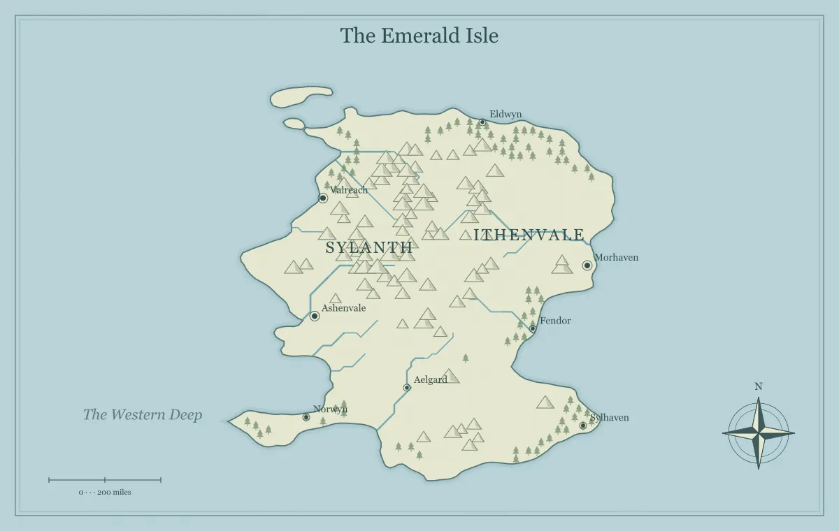
A DND world map maker with no login is useful when you want to move directly from an idea to a playable setting. You can experiment with a coastline, choose a style, rename a starting town, and download a handout without creating an account first. That short path is especially helpful before a one-shot or during campaign preparation. It also changes how you should save your work: you need a deliberate local backup routine because an account library is not doing it for you.
This guide uses the DND world map maker to build a compact campaign region called the Ashwater March. The example is an original fictional setting, and the tool is independent of Dungeons & Dragons and its publishers. We will focus on regional decisions that support actual play: a safe base, uncertain routes, competing interests, and enough blank space for players to influence the world.
Choose the smallest useful campaign scope
A world map does not have to explain an entire planet. For a new campaign, the useful world may be one coastal march with a harbor, an inland valley, and a mountain pass. Your players need to understand where they can go and why those places matter. A vast map of twenty kingdoms can be impressive, but it may create preparation work without improving the first session.
Start by naming the campaign's immediate question. In Ashwater, trade caravans have stopped arriving from the eastern pass. That question needs a home town, a route, a barrier, and at least two plausible explanations. It does not yet require the history of every continent. Choose a map type and land shape that support that frame. The campaign world guide expands this approach into locations, factions, and travel choices.
Generate first, interpret second
Open the generator, choose a regional or world view, and produce a few candidates. Judge them against the campaign question rather than looking only for an attractive outline. Is there a clear corridor toward the pass? Is the home town separated from danger by a meaningful distance? Can players choose more than one route? A coastline with fewer elaborate bays may be better if it leaves room for the places your sessions will use.
Once you choose a candidate, save its settings or editable file before making major changes. Give the project a working name and write one sentence about why you selected it. Then interpret the terrain. A river becomes a trade route, an island becomes a place of refuge, and a ridge becomes a disputed boundary. Procedural features are starting material for your campaign decisions, not obligations to populate every symbol on the map.
Give the starting settlement a clear function
The players' base needs to do something in the regional economy. Ashwater's starting town, Ember Quay, stores river grain before it travels along the coast. Its warehouses, ferries, and customs house follow from that function. The missing caravans threaten trade and make the campaign problem visible through rising prices, stranded merchants, and worried families. Geography becomes part of the opening situation without requiring a long exposition scene.
Choose a settlement location that makes this function plausible. A harbor town should have access to water; a crossing town should connect routes; a mining settlement should have a relationship with the hills. You can still use unusual geography, but explain the resource or magical infrastructure that supports it. The city placement guide offers a practical review of water, movement, resources, and defensible positions.
Create choices along the journey
A campaign map becomes playable when it presents different ways to reach a goal. From Ember Quay, the eastern pass can be approached by a guarded road, a marsh track, or a river landing followed by a climb. The road is predictable but monitored. The marsh is secretive but difficult. The river route is quick in one direction but depends on a boat and favorable conditions.
Describe each choice with information players can obtain. A choice between three unknown lines is not very meaningful. Let a ferryman explain the water conditions, a courier warn about the road patrol, and a local guide discuss the marsh. You do not need exact movement calculations on the first regional handout. You need enough relative geography to support a decision. For travel planning, see DND travel routes and connect obstacles to consequences.
Prepare a few locations deeply enough to use
Select three adventure locations near the starting problem. Ashwater has an abandoned toll station, a damaged river shrine, and a quarry camp below the pass. Give each one a visible identity, a reason to visit, and a situation that can change. The toll station might be occupied by displaced travelers rather than monsters. The shrine might contain evidence of flood damage that explains why the normal route failed.
Keep the details proportional to the next session. A regional map marker does not need a complete encounter layout immediately. Write a short description and the questions players can answer there. If combat or detailed exploration becomes likely, prepare a separate local map. A world map is for orientation and strategic choices; it cannot replace every smaller scene. The ruins and landmarks guide helps give a symbol a purpose beyond filling empty space.
Attach factions to resources and routes
Factions become easier to understand when the map shows what they depend on. The river merchants need ferries to operate. The pass wardens need toll income and secure supply. The marsh villages need access to dry-season grazing. None of these groups has to be wholly good or wholly hostile. Their interests can overlap, and the players' actions can improve one relationship while complicating another.
Write one present goal for each group and one location where that goal becomes visible. Avoid drawing hard borders around every influence unless the setting supports them. A merchant association may influence several towns without ruling the land between them. A border patrol may control the road while villages beyond it remain independent. The factions and territory guide explains how to show overlapping control without misleading players about what a colored region guarantees.
Prepare an honest player-facing map
A player map should show what the characters could reasonably know. That may include Ember Quay, the main river, the old road, and the mountain pass. A concealed camp or secret entrance can remain in your notes. Removing a label is not enough if a distinctive marker still reveals the hidden location. Review symbols, title text, and the legend as well as place names before distributing the image.
Uncertainty can be part of the fiction. An old route might be labeled as unreliable, or a remote island might carry a rumored name. Make the uncertainty clear rather than presenting a false measurement as authoritative. Save a separate game master version and compare both exports before sharing. The player and DM map guide provides a systematic information check for secrets, rumors, and visible consequences.
Understand what no login changes
No login removes an account step from creation, but it also means you should not expect an account dashboard to store every project. The browser may retain local settings, yet local storage can be cleared by browser settings, private browsing behavior, or device changes. Treat that convenience as a recent-work aid, not your only archive. Save important maps to files under your own control.
Use the editable JSON download for your working version and a PNG or SVG export for the handout. Store both in the campaign folder with matching names. If you switch computers, import the JSON rather than assuming the new browser knows your earlier work. The editable map backup guide walks through a small routine that preserves settings and supported edits without requiring an account or a database.
Make the handout readable at the table
For a printed regional overview, emphasize the locations the group will discuss first. The home town, destination, and major barriers should be recognizable without zooming. Small decorative labels can be omitted if they compete with those essentials. Print one test copy before a session and view it from an ordinary seating distance. A beautiful screenshot viewed close to your monitor is not the same as a useful shared handout.
For online play, check the map on the screen sizes your players use. Keep a larger image available for details, but offer a simple overview that loads quickly and fits the conversation. Choose PNG when crisp lines and text matter, or another supported format when your platform requires it. The export guide explains raster dimensions, SVG checks, and the difference between a distribution image and an editable working file.
Update the world after play
The strongest campaign maps respond to events. If players repair the river shrine, the ferry route may become reliable. If they ally with the marsh villages, a new path may become available. If a faction loses its supply, its patrols may retreat. These changes give the players evidence that their choices matter. They are more meaningful than adding a dozen unrelated markers after every session.
Keep a dated version before substantial updates. Record what changed and why in a short session note, then revise the relevant labels or landmarks. Preserve the old handout when it documents earlier knowledge. The between-session map guide explains how to separate changes in the world from changes in what the characters know, which helps maintain continuity without rewriting the whole setting.
Run a final preparation check
Before your first session, point to the starting town, the immediate problem, and the main travel choices on the exported image. If those are hard to explain, simplify the map or refine the premise. Then verify that the player version contains no unwanted secrets, that your working file is saved, and that the image opens in the tool your group will use. These checks usually matter more than another round of random generation.
A DND world map maker with no login is most useful when it frees time for decisions about play. Use the generator to obtain terrain, then spend your attention on choices, consequences, and readable information. Ashwater can grow into a larger world later. For now, a harbor, a pass, three routes, and several competing interests are enough to give players a place they can understand and a situation they can change.
Give the idea a world of its own.
Try the technique in the generator, then save an editable copy so you can return to your work.
Open the map maker ↗