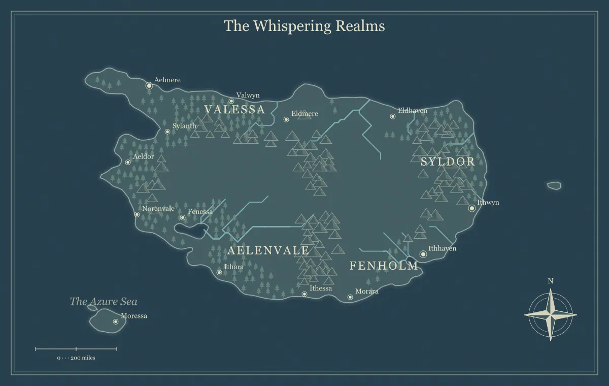
Borders on a fantasy map tell the audience something about authority, but they need a clear meaning. A line can represent an accepted administrative boundary, a claim one ruler makes, or the uncertain edge of practical control. Those are different relationships. If you draw every realm as a tidy block without deciding what the boundary means, the map can create expectations the story does not support. Believable borders connect geography, institutions, and history.
This guide develops an original region called the Vale March using the fantasy map maker. The generator provides fictional geography and supported labels or landmarks, not a complete political-polygon editing system. You can describe territory through region labels and notes, or use a suitable external workflow for custom overlays. We will focus on deciding what a boundary communicates and keeping the geographic map readable.
Define the border's meaning before its shape
Write a sentence explaining the relationship. “The council administers the valley towns” differs from “the council claims the whole valley.” “Patrols commonly use this road” differs from “the surrounding land belongs to the patrol.” A border line should not silently combine all of those ideas. Decide which information the audience needs and represent that information deliberately.
In the Vale March, the southern towns recognize the council's market rules, while the northern villages maintain separate local agreements. The formal claim reaches beyond the council's dependable services. That difference gives the frontier a useful identity. The faction guide distinguishes rule, ownership, and influence, while kingdom design connects authority to a wider setting.
Use physical features as context rather than automatic borders
A river, ridge, coast, or difficult region can help explain a boundary, but the physical feature does not decide the political agreement by itself. A river might separate administrations or connect communities through ferries and markets. A ridge might be a barrier in one place and contain a regularly used pass elsewhere. Choose the relationship that fits the history and current institutions.
The Vale March uses a ridge to frame the region, but its main pass supports exchange across the boundary. The mountain guide explains crossings and access, and river design connects water to movement and settlements. A physical boundary becomes convincing when the notes explain how people actually use or cross it.
Map practical authority through services
Ask which institutions operate reliably on each side. Roads, records, inspections, ferries, supply, and dispute resolution can make authority visible in ordinary life. The council maintains the southern road and collects market fees. Farther north, local associations organize crossings. Those service patterns explain practical control more clearly than a title that claims everything inside a broad outline.
You do not need detailed administrative procedures for every village. Select the services likely to affect the story or play. The frontier town guide develops a settlement through resources and overlapping authority, while travel routes explains how services and checkpoints change choices. The map can locate the important centers, and an index can explain their roles.
Treat a frontier as a condition, not necessarily an empty strip
A frontier can be a zone where authority overlaps, infrastructure becomes less reliable, or information differs between communities. It need not be uninhabited land. The characters' chart may show few labels while local residents know the area well. Decide whose viewpoint the map represents before treating blank space as a fact about the people who live there.
In the Vale March, northern villages use routes absent from the council's public chart. That is a knowledge difference, not proof that the routes do not exist. The audience map guide separates known, rumored, and private information. The hidden realm guide distinguishes unknown places from physically concealed or inaccessible ones.
Give crossings consequences the audience can understand
If a border matters to a journey, establish what changes at the crossing. Travelers may encounter a checkpoint, a different fee system, a local agreement, or simply another institution responsible for the road. Avoid making the consequences entirely hidden when the audience needs to choose a route. Useful information can come from residents, travelers, or the map's accompanying note.
The Vale March's main pass has a public inspection station, while the northern trail requires local guidance and has fewer services. Neither route is universally better. The route guide develops those tradeoffs. The border becomes a meaningful part of geography when crossing it changes practical options rather than merely the color behind the next town name.
Keep disputed claims explicitly disputed
Two groups can make incompatible claims without the map choosing one as unquestioned truth. Decide whether the image represents an official chart, a neutral overview within the fiction, or one character's notes. An official chart may show its administration's claim, but a caption should establish that viewpoint if it affects the audience's interpretation.
Keep the dispute understandable through specific places and interests. A quarry, crossing, or market can matter to both groups for different reasons. The trade guide connects resources and movement, and faction mapping links goals to assets. A contested zone becomes richer when the disagreement concerns practical dependencies rather than only rival names on a map.
Give boundaries a history with surviving consequences
A boundary can reflect an older agreement, a changed route, a past conflict, or a settlement pattern that no longer matches current influence. Choose one history relevant to the project. The Vale March's council inherited a claim to northern stations but no longer supplies all of them. Old signs and road records can preserve the claim while current communities operate differently.
Record what remains visible and who remembers the history. You do not need a complete chronology for every segment of the boundary. The landmark guide connects past function to present sites. A former checkpoint or abandoned road can show change through geography, making the border's history useful to a scene rather than an isolated paragraph of lore.
Allow overlapping affiliations and ordinary cooperation
A person or community can participate in several networks. A northern village may recognize a local council, trade through the southern market, and use the river association's ferry. Those relationships need not become a contradiction. A regional map can show the places, while the notebook records the agreements that connect them. Political identity is not always a single color covering every aspect of life.
Cooperation can be as important as conflict. Shared maintenance, seasonal access, and commercial agreements can keep the region functioning despite disputed claims. The collaborative worldbuilding guide helps maintain complex shared facts, while the notebook guide organizes roles and sources. Choose the relationships that matter rather than making every overlap another battle line.
Choose a restrained visual method
For a simple overview, broad region labels and a clear caption may be enough. If you need a detailed border overlay, use an appropriate external layout or vector workflow with a suitable export. The current browser editor does not provide unrestricted polygon drawing for political regions. Preserve the edited source separately when external geometry becomes part of the approved map.
Keep line meanings distinct if you add roads, boundaries, and influence zones. Explain them in a legend or nearby prose and do not rely only on subtle color differences. The label guide supports hierarchy, and monochrome printing helps preserve meaning without color. The overlay should not hide the physical geography that explains the territory.
Use territory names and place names consistently
A realm name, administrative district, valley name, and settlement label can refer to different extents. Decide which one appears where. Vale March names the political region, North Vale names a physical area, and Reedgate names a crossing town. Keeping those levels clear prevents a later boundary revision from seeming to move the valley itself.
Record aliases and official names in a register, especially when a dispute produces different terminology. The naming guide explains layered labels. Use one principal label on a particular map and explain alternatives when they matter. A handout becomes easier to use when the audience does not have to guess whether two similar names describe separate places or competing names for one location.
Update borders through events rather than automatic redraws
A change in who operates a station may affect practical control without changing a formal claim. A negotiated agreement may alter crossing conditions without transferring the whole region. Record the specific event and its consequence before revising the map. Avoid converting every successful negotiation into a new hard territorial line unless that is what the setting actually establishes.
The maintenance guide distinguishes world changes from new knowledge. Save a version before major revisions and retain earlier approved handouts when they represent the campaign's history. The saving guide helps preserve supported edits. Stable physical geography can remain useful while political relationships evolve around it.
Compare three maps of the same Vale March
The council's official chart labels the northern station as part of its administration because an old agreement records that claim. A merchant's route chart identifies the station mainly as a place where supplies are unreliable. A village sketch emphasizes a nearby trail and meeting ground instead. The three views can share the same ridge and river while showing different information. Their differences should have a stated reason rather than appear as accidental errors between files.
Keep one underlying geographic reference and a note about each map's source. If a character obtains the official chart, it can tell them what the council believes or wants others to recognize. The merchant chart can help them plan services. The village sketch can reveal local knowledge absent from the broader overview. None has to provide every private fact, and none should be treated as a universal authority merely because it has a neat border line.
Before publishing one view, decide which interpretation its audience is likely to make. A caption such as “council claims shown; local access varies” can prevent an incorrect expectation about control. Nearby prose can explain the distinction when a compact label would crowd the image. This comparison is especially useful for an author or game master who wants a disputed frontier to remain understandable while allowing discovery. The geography stays stable; the meaning of the information depends on the viewpoint and its limitations.
Test the Vale March through one crossing
Describe a traveler moving from the southern market to a northern village. Identify which institution handles the road, what the checkpoint requires, what information the traveler can obtain, and where local guidance becomes important. If the answer depends only on a colored line with no practical meaning, develop the relationship before adding more borders.
Then inspect the exported map and caption at the intended size using the export guide. A believable frontier communicates claims, services, knowledge, and history without pretending that all of them are the same. The Vale March becomes a coherent political landscape when its boundaries explain useful relationships and leave room for people to cooperate, disagree, and change what practical control means.
Give the idea a world of its own.
Try the technique in the generator, then save an editable copy so you can return to your work.
Open the map maker ↗