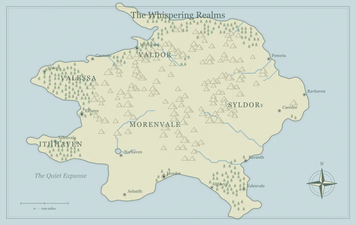
Forests can give a fantasy map texture, but their strongest contribution is the relationship they create between places. A woodland can provide timber, hide a route from outsiders, support a community, or preserve evidence of an older settlement. It can be familiar working land to residents and uncertain terrain to travelers at the same time. Treating every forest as an identical dangerous blank area misses those possibilities and makes the world less varied.
This guide develops an original woodland region called the Brindlewood with the fantasy map maker. The generator uses illustrated terrain symbols and a forest setting; it does not assign a verified species list or ecological history to every tree. We will decide what the woodland means, connect it to routes and settlements, and keep the regional image readable. Your notes provide the detail that a broad geographic illustration cannot express alone.
Choose the forest's first role
Write one sentence about the woodland's function in your project. It might support a boatbuilding town, separate two travel routes, shelter a hidden community, or form the setting for a character's home. For Brindlewood, the forest supplies timber to a river crossing and contains an older trail used by local residents. That gives it both an economic and a movement role before you add any mysterious landmark.
A forest can later gain more functions, but a clear starting role helps you decide what to show. If the story concerns timber supply, the camp and route matter. If it concerns concealment, viewpoint and local knowledge matter. The mapmaking workflow turns the brief into staged decisions, while city placement connects a settlement to its surrounding resources.
Consider environment without pretending to simulate it
Vegetation varies with environmental conditions, and a forest illustration does not establish one universal species mix. The US Forest Service's California coastal province description gives a real example of vegetation varying with moisture, elevation, and exposure. Use such context to ask better questions about your fictional region, not to copy a real ecosystem without understanding its setting.
For Brindlewood, choose a broad climate and decide whether the forest is continuous, patchy, or mixed with open land at the scale of the map. Keep species details provisional unless they matter to the story. The climate and biome guide helps establish regional assumptions. Generic tree symbols can represent your intended woodland, but the symbol alone does not prove its ecology.
Read forest extent at the map's scale
A small cluster of symbols on a world overview may stand for a large wooded region, while the same-looking cluster on a local illustration could represent a much smaller area. Define the geographic scope before making precise claims about its size. The density of drawing is a presentation decision as well as a terrain signal; it does not automatically count trees or measure canopy cover.
View Brindlewood in the complete image and decide whether the woodland's broad position is clear. If the forest setting makes labels hard to read, compare a less dense presentation while preserving the useful geography. Save the working file first and inspect other features after the change. The scale guide separates fictional size from image dimensions, and iteration explains controlled comparisons.
Make the forest an inhabited relationship
A forest can contain settlements, work sites, gathering places, and routes known to residents. It need not be an empty wilderness from everyone's viewpoint. Brindlewood's edge village maintains a trail and exchanges timber with the river town. People who use the forest regularly may understand its seasons and landmarks even when travelers find it unfamiliar. That difference can enrich the setting without making one audience's ignorance a fact about the land.
Choose a few people or groups connected to the woodland's function. A timber crew, a trail keeper, and a riverside boat repairer can explain the network through practical concerns. Keep their interests distinct rather than giving every resident the same attitude toward outsiders. The frontier town guide explores services and dependencies, while faction mapping connects control to concrete assets.
Treat paths as knowledge as well as geometry
A route through woodland can be physically present but poorly documented on the characters' chart. Local guidance, maintained markers, and known stopping places can make it easier to use. Decide what information travelers can obtain before departure. A forest route should not become a random penalty merely because it passes through tree symbols on the overview.
In Brindlewood, the public road skirts the forest and offers regular services. The older trail crosses it more directly but depends on local knowledge and has fewer stops. Those tradeoffs create a meaningful choice. The travel route guide explains distance, effort, and uncertainty, and audience versions helps distinguish known routes from private preparation.
Connect resources to extraction and movement
If the woodland supplies timber or another resource, decide how that material reaches the people who use it. Brindlewood has a work camp near a route toward the river crossing. The town's repair yard depends on deliveries, while the camp depends on food and tools from the town. These simple dependencies make the forest relevant to current situations without requiring detailed production figures.
Also decide who has access and what agreements govern use. A formal owner, a local customary arrangement, and practical control of the road can be different relationships. The trade route guide connects production to movement, while borders and frontiers helps avoid treating a colored realm label as proof of uniform control over every wooded area.
Give open spaces a purpose
A clearing or open area can hold a settlement, grazing, a work site, or a place with historical significance. The regional generator does not provide a measured inventory of such spaces, so use notes or a local sketch when exact placement matters. On the overview, a named location can stand for the relevant site while the forest remains a broad terrain feature.
Choose one clearing that supports the story instead of populating every apparent gap. Brindlewood's meeting ground lies near the junction of two trails and explains why several communities gather there. A separate work clearing supports timber handling. Their different roles make the woodland varied. The landmark guide connects sites to function and history, and the notebook guide keeps local detail outside the crowded image.
Use concealment with a clear viewpoint
Forested terrain can support a story about limited knowledge, but decide exactly what is concealed and from whom. A settlement may be absent from a merchant chart while familiar to nearby villagers. An old structure may be difficult to locate without a trail. These are different conditions from a magically inaccessible realm. The explanation should remain consistent when the audience learns more.
Keep secret markers out of the player version unless the characters have an appropriate source. Do not assume that deleting a label hides a conspicuous icon. The hidden realms guide distinguishes unknown, concealed, and inaccessible places, while player and DM maps provides a release audit. A useful public forest still needs enough information for travelers to make choices.
Let woodland history affect the present
An old road, abandoned settlement, or ruined mill can indicate that the forest's use changed. Choose a reason relevant to the current region. A route may have lost importance after a bridge opened elsewhere. A former village may be remembered through a local name. The remaining evidence can provide a lead or explain a dispute without requiring every tree to hide an ancient mystery.
Record what residents know and what remains uncertain. If a ruin's past is disputed, present the sources rather than one unexplained authoritative label. The ruins guide develops past function and present situations. The woodland becomes more believable when its history includes ordinary work and travel as well as exceptional events.
Name the woodland and selected places at different levels
Brindlewood names the broad region. Alder Camp, the Old Track, and Meeting Green identify specific functions within it. This hierarchy lets the audience discuss the forest as a whole and a particular destination without naming every symbol. Keep the most important spoken labels distinct from nearby town names, especially when the map will be used during conversation at a table.
Place the broad forest label where it does not hide essential settlements or routes. Keep detailed origin stories and aliases in a register. The naming guide explains layered names, and label typography covers size and spacing. A readable woodland overview often needs fewer labels with clearer roles rather than additional decorative text.
Use seasonal or political changes selectively
A temporary route closure, a work agreement, or a change in who maintains the trail can affect travel without changing the forest's entire outline. Decide what actually changes and what remains stable. If a campaign event alters access, record the condition in the route note. If the characters discover a path, record a knowledge change rather than claiming the path was newly created.
The maintenance guide explains this distinction. Save a version before major updates and preserve the approved appearance. The generator's browser storage is convenient but not a substitute for a working archive. The editable saving guide provides a recovery routine so later changes do not erase useful manual labels or added landmarks.
Test Brindlewood through one delivery
Imagine a timber shipment traveling from Alder Camp to the river repair yard. Identify the route, who maintains it, where supplies come from, and what happens if the shipment is delayed. Those questions test whether the forest belongs to the world as a connected place. A damaged trail can lead to negotiation, a longer detour, or help from another community rather than one compulsory encounter.
Now explain what a traveler knows before choosing the old trail over the public road. If that information is unavailable, add an appropriate source at the town or camp. The map should support the comparison while your notes supply the conditions. A coherent forest network can create varied scenes without needing a new location every time someone moves through it.
Review the woodland at its destination size
Open the exported image and check the forest name, important sites, and nearby river or road relationships. If dense symbols overwhelm the main labels, revise the presentation or simplify the information. Use the style guide for palette comparisons and the export guide for file checks. A print or small-screen test can reveal crowding that close-up editing hides.
Brindlewood becomes useful because it supports residents, resources, routes, knowledge, and history. The generator supplies a visual terrain pattern, while deliberate interpretation gives that pattern meaning. Keep the broad relationships clear and local details in recoverable notes. A forest with a purpose can enrich a fantasy world far more than a larger number of tree symbols placed without a reason.
Give the idea a world of its own.
Try the technique in the generator, then save an editable copy so you can return to your work.
Open the map maker ↗